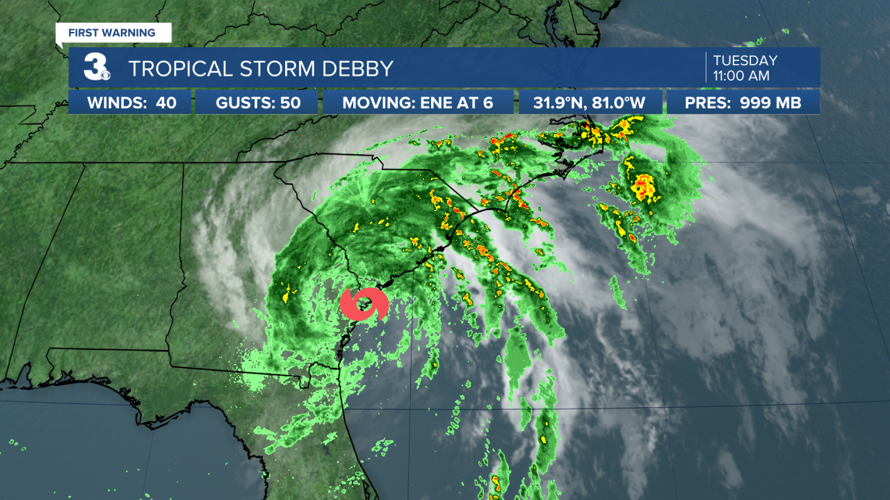
Tropical Storm Debby is moving over southern Georgia before it's expected to meander near the South Carolina coast over the next couple of days.
On the forecast track, the center of Debby is expected to move off the coast of Georgia later Tuesday and Tuesday night, continue to drift offshore through early Thursday, and then move inland over South Carolina on Thursday.


Maximum sustained winds are near 40 mph with higher gusts. Some strengthening is forecasted for Wednesday and Thursday while Debby drifts offshore. Tropical-storm-force winds extend outward up to 205 miles from the center.
Watch First Warning Forecast: Rainfall from Debby covering the Southeast
Our rain chances will increase for the end of the week as the remnants of Hurricane Debby move up the East Coast.
Expect widespread rain with scattered storms on Wednesday, Thursday, and Friday. Most of the region should see 3” to 6” of rainfall with locally higher totals possible.
Strong to severe storms are possible, mainly for Thursday and Friday. Winds will kick up on Thursday and Friday but should remain below tropical storm strength.
Based on the current forecast track, the remnants of Debby should move to our northeast through the day on Saturday. We should see more sunshine and start to dry out on Sunday.
Watch: Debby makes landfall Monday morning
Hurricane Debby made landfall off the coast of Florida Monday morning as a category 1 storm around 7 a.m. with 80mph sustained winds and gusts over 100mph.
Around 11 a.m. on Monday, Debby was downgraded to a tropical storm as it passed over land.


