Chief Meteorologist Patrick Rockey's First Warning Forecast
Get ready for even colder and windier weather over the next few days. That will make for some rough mornings, with wind chills near zero in some communities.
With plenty of cold air in place, a storm system moving out of the Gulf of Mexico could bring us another dose of snow late Friday night and through the first half of Saturday.

But what we get all depends on the eventual track of this area of low pressure.
If the low stays farther south, we'll likely see mostly snow. I'm giving it a 40% chance that the low follows this track.

If the low jogs a little farther north, we'll see mostly a wintry mix of rain, sleet and snow because it will bring some warmer air. This track has a 30% chance.

And if the low moves directly over our region, we'll see temperatures climb significantly and we'll see mainly rain. This track also has a 30% chance.

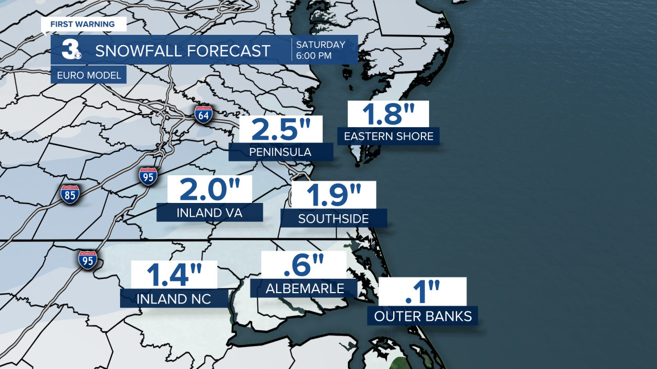
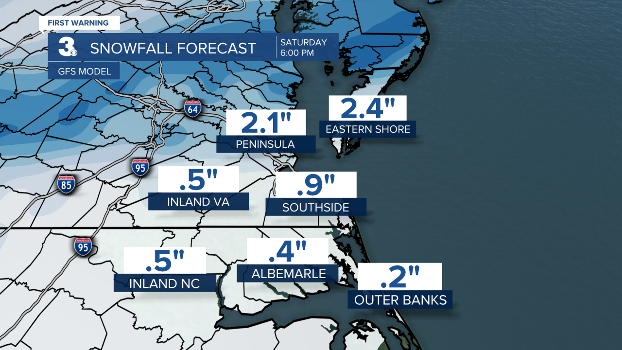
Our two longer-range forecast models are split. The European Model is painting in mainly snow and the GFS shows a mix of rain, sleet and snow.

As a result, the EURO is the most aggressive with snow accumulation. While the GFS paints in lower totals.

Either way, this should be a fairly fast-moving storm, which will limit how much of anything we get. Stay tuned.
Weather updates on social media:
Facebook: PatrickRockeyWeather
Instagram: @patrickrockey
X (Twitter): @PatrickRockey


