Chief Meteorologist Patrick Rockey's First Warning Forecast
I'm calling this week "May-vember," since it's feeling more like spring than the middle of fall. But a pair of cold fronts will usher in sharply cooler and windy weather to end the work week.

Expect some scattered showers when you wake up on Wednesday morning, ahead of the first cold front. We're not expecting a solid line of rain, just widely scattered showers throughout the day.
As the surface cold front gets closer, we can expect more showers on Wednesday night and early Thursday morning.

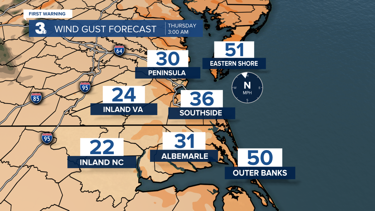
The winds will also really kick up as the front moves in. Some of us along the coast could briefly see wind gusts in excess of 50 mph.
It'll be windy and cooler when we wake up on Thursday morning, with mainly clear skies.
But as the second front arrives in the afternoon, clouds will increase again and a stray shower is possible. Expect highs in the mid 50s on Thursday.

The chillier air really takes hold on Friday. Despite plenty of sunshine, we'll only climb into the lower 50s. And the gusty north and northwest winds will make it feel even cooler.
We'll enjoy a lot of sunshine for the weekend and temperatures will climb back into the upper 50s and lower 60s. But it'll still be on the windy side, especially on Saturday.
Weather updates on social media:
Facebook: PatrickRockeyWeather
Instagram: @patrickrockey
X (Twitter): @PatrickRockey


