
Meteorologist April Loveland's First Warning Forecast
Mostly clear and cool overnight with lows in the 40s. Some patchy fog is possible on Tuesday morning.
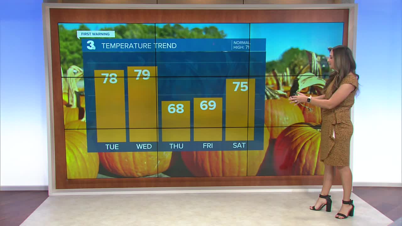
Expect wall-to-wall sunshine again on Tuesday. Temperatures will warm to the mid and upper 70s, which is warm for this time of year.
A cold front will approach on Wednesday. Temperatures will once again warm to the upper 70s. We may see a few more clouds and perhaps a few sprinkles. For the most part, though, it will be dry and warm.

Thursday will be dry and cooler with highs falling into the upper 60s.

The 60s will continue to end the work week, with sunshine prevailing.
The weekend will have a mix of temperatures, but both days are looking dry. Saturday will be the warmer day with highs in the mid 70s. Cooler behind a cold front on Sunday, with highs in the low 60s.
Dry weather and sunny skies will kick off the work week, with highs in the mid 60s.

Meteorologist April Loveland
For weather updates on Facebook: HERE
Follow me on Twitter: HERE
Follow me on Instagram HERE
Check out the Interactive Radar on WTKR.com: Interactive Radar
