


Meteorologist Myles Henderson’s First Warning Forecast
Warm and breezy again today. Strong to severe storms tonight. Highs in the 60s for midweek, 80s to end the week.
Another warm and breezy day with highs near 80 and a SW wind at 10 to 20 with higher gusts. We will see a mix of partly to mostly cloudy skies today with an isolated shower possible.
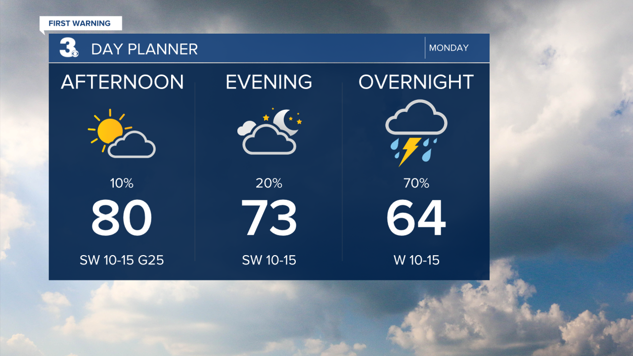
A line of storms is set to move through tonight with a cold front. The biggest chance for storms will be 8 pm to midnight. Strong to severe storms are possible with a threat for damaging wind gusts, isolated tornadoes, and pockets of hail.

Look for clearing skies Tuesday morning. It will be much cooler tomorrow with highs only reaching 60.
Near normal on Wednesday with highs in the mid 60s. Warming back to the 80s for Thursday and Friday. Tracking another opportunity for showers and storms Friday and this weekend.

Today: Mix of Clouds, Breezy. Highs near 80. Winds: SW 10-20
Tonight: Showers & Storms. Lows in the low 50s. Winds: W 10-15
Tomorrow: Clearing Skies, Breezy. Highs near 60. Winds: N 10-15
Weather & Health
Pollen: High (Maple, Juniper, Birch)
UV Index: 7 (High)
Air Quality: Good (Code Green)
Mosquitoes: High
Weather updates on social media:
Facebook: MylesHendersonWTKR
Instagram: @MylesHendersonWTKR
