


Meteorologist Myles Henderson’s First Warning Forecast
Several chances for showers and storms to end the week. A cool down to start next week.
A break from the heat but not the humidity. Highs will dip to the mid 80s today but it will still feel like the mid 90s. Expect partly to mostly cloudy skies with scattered showers and storms, mainly in the afternoon to evening.

Highs will remain in the mid to upper 80s Saturday. It will still be humid, so afternoon heat index values will reach the mid 90s. Expect partly cloudy skies with isolated showers/storms possible.
Highs will warm to near 90 on Sunday with an afternoon heat index near 100. Expect a mix of sun and clouds with showers and storms building in the afternoon. Some storms could be strong to severe.
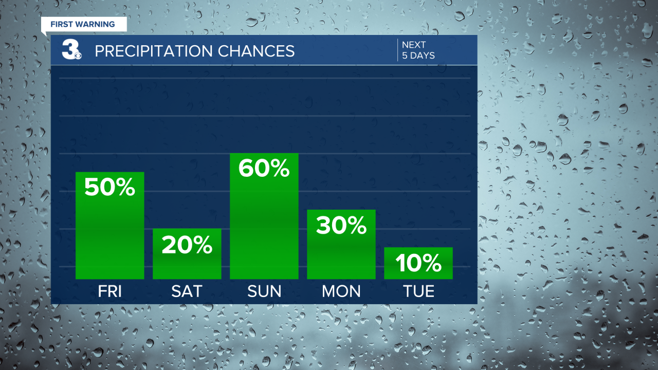
Labor Day will be a weather transition day. Highs will drop to near 80 with the humidity falling throughout the day. A leftover shower or storm is possible, especially in the morning.
Another round of fall-like weather is set to return for mid-week with highs in the 70s and lower humidity.
Today: Scattered Storms. Highs in the mid 80s. Winds: E 5-10
Tonight: Partly Cloudy. Lows in the low 70s. Winds: E/S 5-10
Tomorrow: Isolated Storms. Highs in the mid 80s. Winds: S 5-10
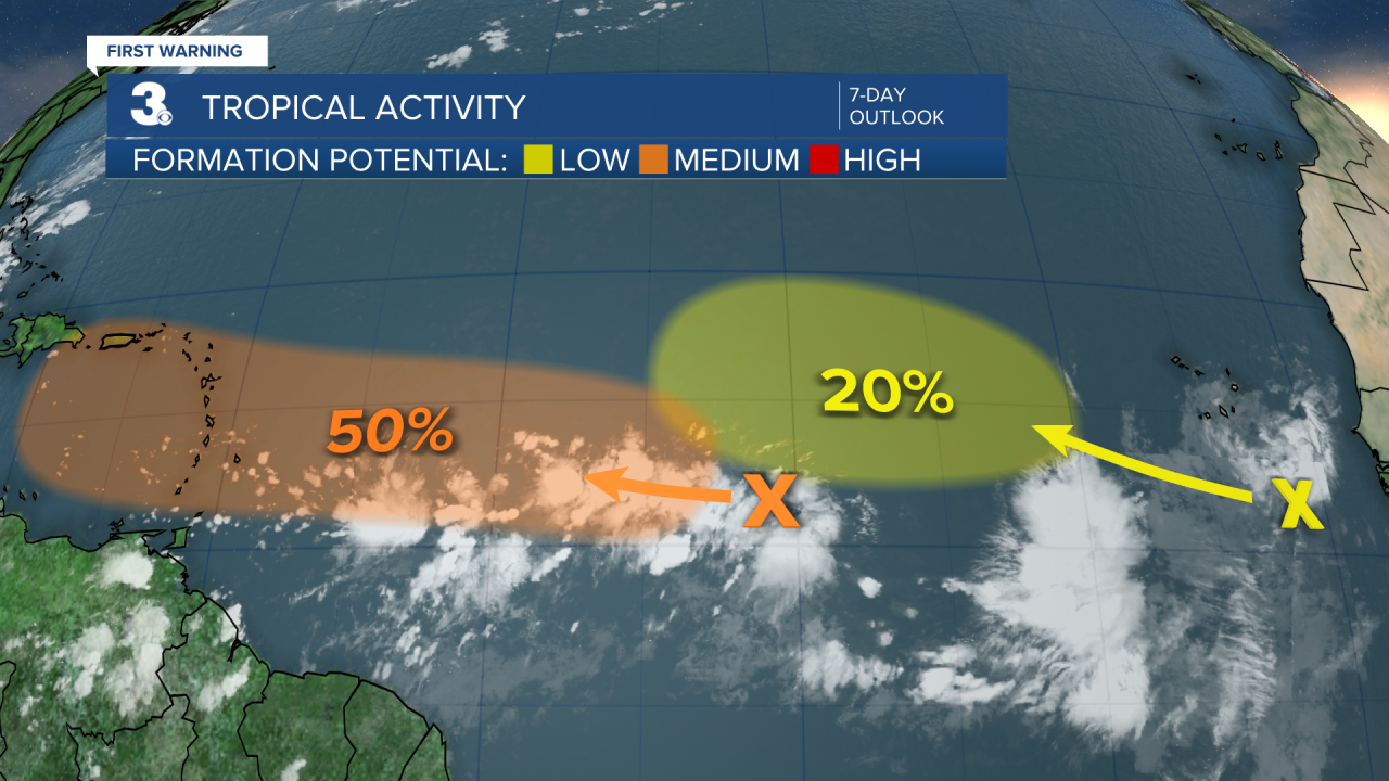
Tropical Update
Tracking a tropical wave over the central Tropical Atlantic. Environmental conditions appear conducive for gradual development of this system. A tropical depression could form by early next week while it moves toward the Lesser Antilles. The system is then forecast to move across the Caribbean Sea next week.
* Formation chance through 48 hours: Low (10%)
* Formation chance through 7 days: Medium (50%)
Watching another tropical wave just west of the coast of Africa. Some slow development of this system is possible through the middle portion of next week as it moves over the Eastern Tropical Atlantic.
* Formation chance through 48 hours: Low (0%)
* Formation chance through 7 days: Low (20%)
Weather & Health
Pollen: Med-High (Ragweed, Grasses)
UV Index: 8 (High)
Air Quality: Moderate (Code Yellow)
Mosquitoes: Extreme
Weather updates on social media:
Facebook: MylesHendersonWTKR
Instagram: @MylesHendersonWTKR
X (Twitter): @MHendersonWTKR
