


Derrah Getter's First Warning Forecast
Mainly dry conditions persist for the rest of the evening. An isolated shower or two will be possible but the rest of us will be stuck with the pesky cloud cover. Mostly cloudy skies tonight with lows in the low 70s.
A mild start to your morning Thursday with temperatures out the door in the low 70s. We'll be off to a cloudy start to your day. A few breaks in the clouds possible mid to late morning. Rain chances will be relatively low with highs in the low 80s. The clouds will begin filling in Thursday night.

Friday will be the day with the highest rain chances. The majority of the area is under a level 1 out of 5 severe weather threat. Isolated tornadoes and damaging wind gusts will be possible. As of now, the timing looks to be Friday afternoon through Friday night. We'll start drying out overnight Friday.
Your weekend doesn't look too shabby. Skies will be a bit brighter with isolated showers possible each day. Highs will be in the upper 70s and low 80s. Next week we could see a resurgence of moisture from Helene at the beginning of the week. Drier conditions return as we head into the middle of the week.

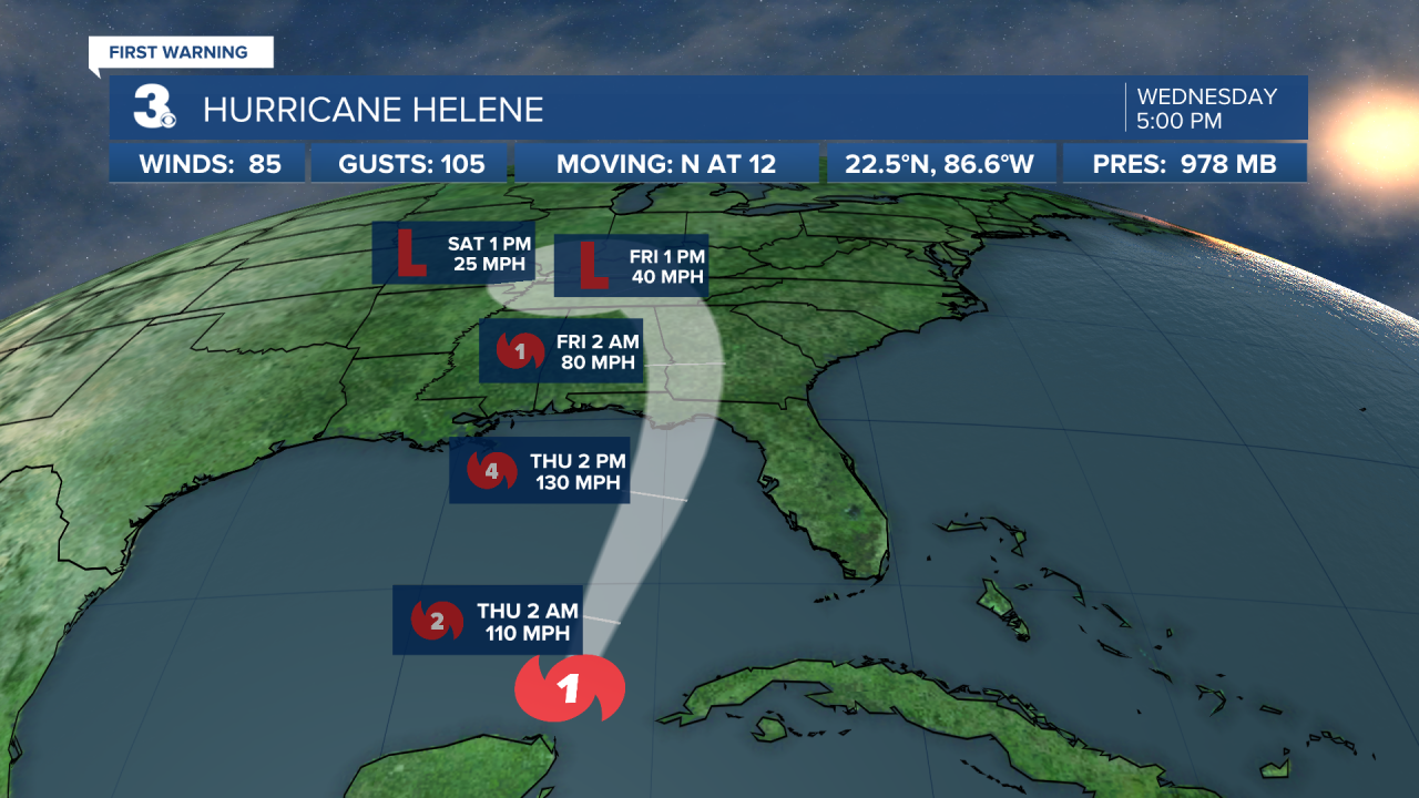
Hurricane Helene Update 9/25/2024:
Helene is forecast to strengthen to a major category 4 hurricane by tomorrow evening. Catastrophic storm surge of 15-20 feet is a possibility for portions of Florida along the Big Ben coast. Anywhere from 8 to 12 inches is expected to fall near where Helene makes landfall. Its current track shows it drifting toward the Midwest as a remnant low. Coastal Virginia and North Carolina should monitor for severe weather impacts expected to arrive Friday.
Let's connect on social media!
Forecaster Derrah Getter:
For weather updates on Facebook: HERE
For weather updates on Twitter: HERE
Follow me on Instagram: HERE
Check out the Interactive Radar on WTKR.com: Interactive Radar
