


Meteorologist Myles Henderson’s First Warning Forecast
*** Heat Advisory in effect Thursday for most of SE VA and NE NC. Afternoon heat index values around 105 expected.

*** Excessive Heat Watch in affect for Friday and Saturday for most of SE VA and NE NC. Afternoon heat index values up to 111 possible.

Even more heat and humidity. Heat index near 110 to end the work week. Tracking a cold front for Sunday.
Another step warmer today with highs in the mid 90s and an afternoon heat index near 105. Expect mostly sunny skies with slim rain chances.

Highs will reach the upper 90s on Friday with an afternoon heat index closer to 110. Expect a mix of sun and clouds with an isolated shower/storm possible.
Changes move in for the weekend in the form of a cold front. We will still be hot and humid on Saturday with highs in the upper 90s and a heat index near 110. Highs will dip to the upper 80s on Sunday. The cold front will bring us scattered showers and storms with the bigger rain chances on Sunday.
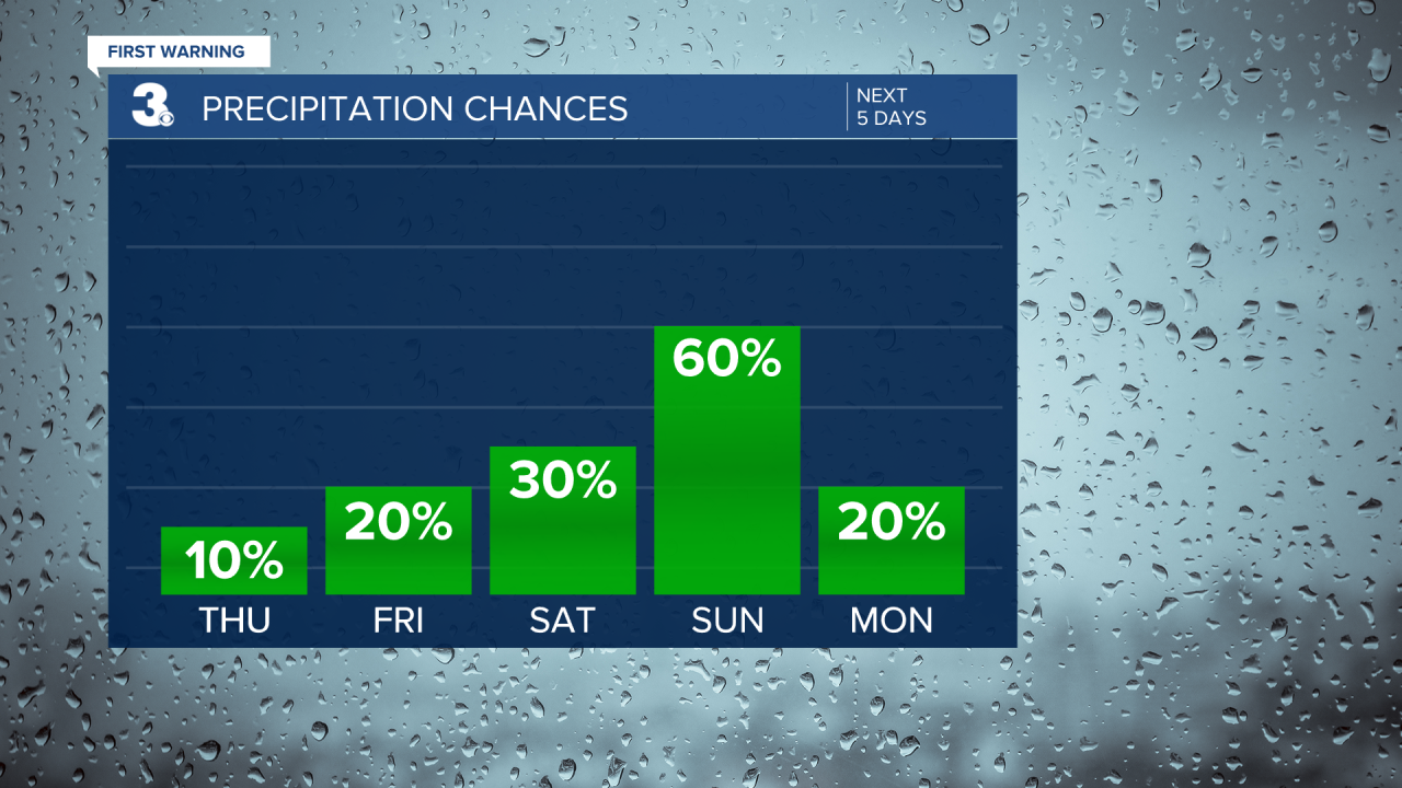
Even cooler and less humid air moves in on Monday. Expect highs in the mid 80s with a heat index in the upper 80s.
Today: A Few Clouds. Highs in the mid 90s. Winds: SW 5-15
Tonight: A Few Clouds. Lows in the upper 70s. Winds: SW 5-15
Tomorrow: Partly Cloudy. Highs in the upper 90s. Winds: SW 5-15
Weather & Health
Pollen: Medium (Grasses)
UV Index: 10 (Very High)
Air Quality: Moderate (Code Yellow)
Mosquitoes: Extreme
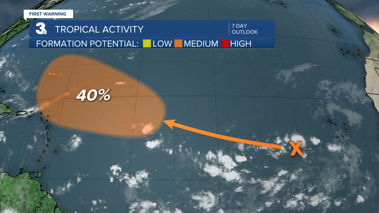
Tropical Update
A tropical wave is located a few hundred miles to the southwest of the Cabo Verde Islands. Conditions are expected to be favorable for gradual development of this system later this week, and a tropical depression could form over the weekend or early next week while it moves west to WNW over the tropical Atlantic.
* Formation chance through 48 hours: Low (0%)
* Formation chance through 7 days: Medium (40%)
Weather updates on social media:
Facebook: MylesHendersonWTKR
Twitter: @MHendersonWTKR
Instagram: @MylesHendersonWTKR
