Meteorologist Myles Henderson’s First Warning Forecast
A very fall-like week with highs in the 60s and 70s. Get the umbrella ready for Thursday. Back to sunshine for the weekend.
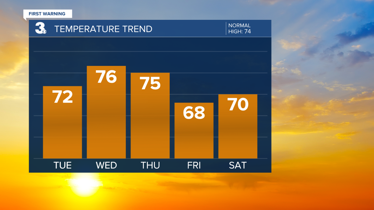
Another chilly morning with temperatures in the 40s, about 10 degrees below our normal low temperature for this time of year. Highs will warm to the low 70s this afternoon with mostly sunny skies.
We will take another step warmer on Wednesday with highs in the mid 70s. Expect partly cloudy skies tomorrow with slim rain chances.

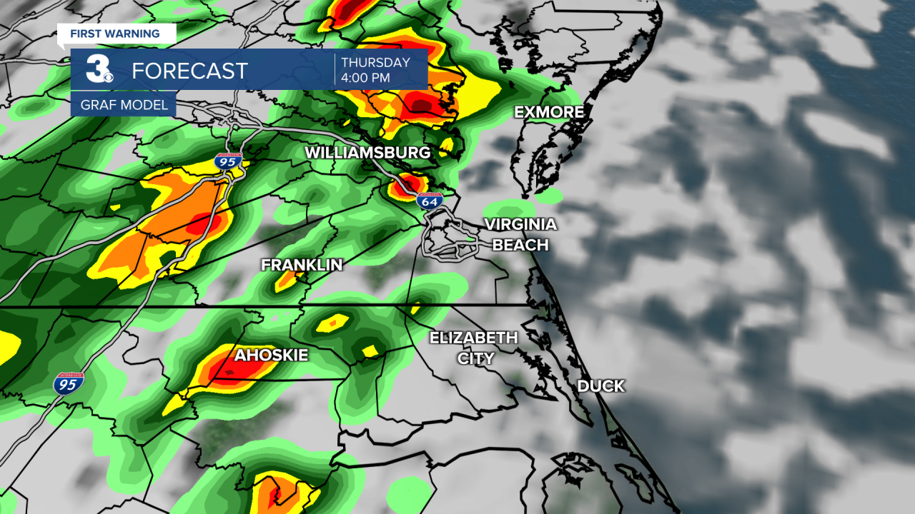
A cold front is set to move through the region on Thursday. Expect mostly cloudy skies with scattered showers and isolated storms. The biggest chance for rain/storms will be in the afternoon to early evening. Highs will return to the mid 70s on Thursday.

Cooler air will move in behind the front. Highs will drop to the upper 60s on Friday as we return to sunshine. The upcoming weekend looks nice! Expect mostly sunny skies with highs in the low 70s both days.
Today: Mostly Sunny. Highs in the low 70s. Winds: N/E 5-10
Tonight: A Few Clouds. Lows in the low 50s. Winds: E/SE 5-10
Tomorrow: Partly Cloudy. Highs in the mid 70s. Winds: SE 5-10
Weather & Health
Pollen: Low-Medium (Ragweed, Grasses)
UV Index: 5 (Moderate)
Air Quality: Good (Code Green)
Mosquitoes: Moderate
Tropical Update
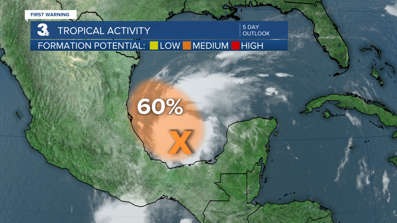
A broad area of low pressure over the Bay of Campeche is producing a large area of showers and thunderstorms. Surface pressures are falling in the region, and radar from Mexico indicates the system is becoming better organized. Environmental conditions are expected to be conducive for further development, and a tropical depression could form within the next day or two while the system moves slowly NW over the southwestern Gulf of Mexico.
* Formation chance through 48 hours: Medium (60%)
* Formation chance through 5 days: Medium (60%)

Weather updates on social media:
Facebook: MylesHendersonWTKR
Twitter: @MHendersonWTKR
Instagram: @MylesHendersonWTKR


