


Meteorologist Myles Henderson’s First Warning Forecast
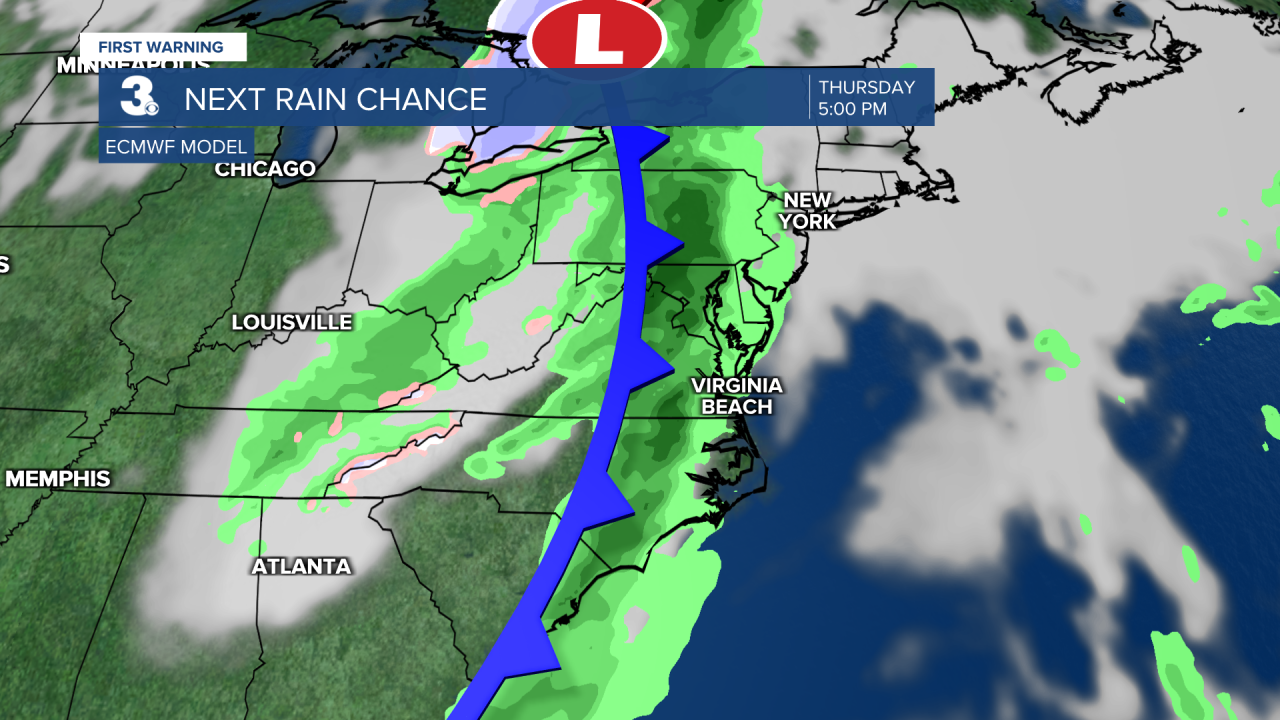
Back to sunshine today. Warming to the 70s for midweek. Tracking our next rain chance on Thursday.
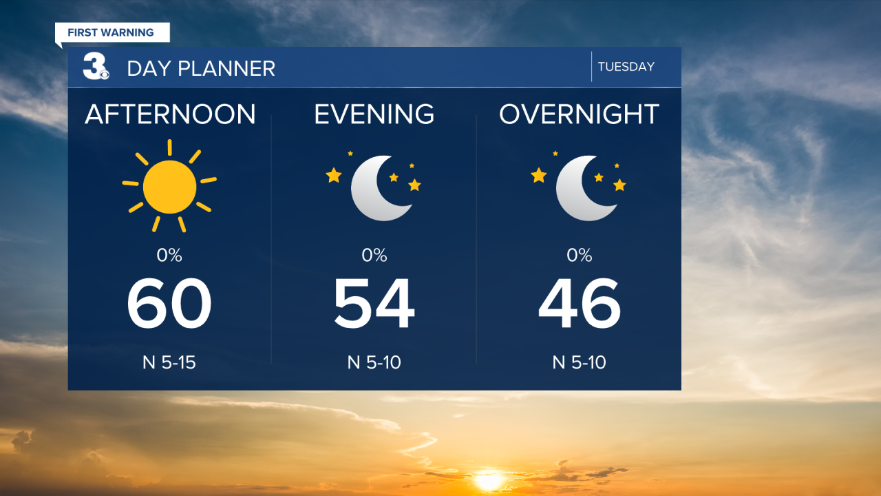
Lots of sunshine today, but still breezy. Expect a north wind at 10 to 15 with gusts 20 to 25 mph. Winds will be strongest this morning, backing down through the afternoon to evening. Highs will top out near 60 today.
We will warm to near 70 on Wednesday. Expect mostly sunny skies during the day with clouds building tomorrow evening/night.
Our next round of rain is set to move in on Thursday with a cold front. Highs will climb to the mid 70s on Thursday and the wind will crank up again. Expect a south wind at 10 to 20 with gusts to 30 mph. The biggest rain chances will be near sunset.
Highs will drop back into the upper 50s on Friday, behind the cold front. It will still be windy with a NW wind at 10 to 20 and gusts to 30 mph.
Today: Sunny, Breezy. Highs near 60. Winds: N 10-15 G25
Tonight: Clear Skies. Lows in the low 40s. Winds: N 5-10
Tomorrow: Mostly Sunny. Highs near 70. Winds: E 5-10
Weather & Health
Pollen: Medium-High (Juniper, Birch, Sycamore)
UV Index: 6 (Medium)
Air Quality: Good (Code Green)
Mosquitoes: Low
Weather updates on social media:
Facebook: MylesHendersonWTKR
Instagram: @MylesHendersonWTKR
