Meteorologist Myles Henderson’s First Warning Forecast
Back to the sunshine to start the weekend but tracking rain to end the weekend. A major cool down on the way early next week.
Clouds will continue to clear out this afternoon with highs near 70. Expect clear skies tonight with lows in the low 50s and upper 40s.
The weather looks great for Saturday! Highs will warm to the mid 70s with lots of sunshine. We will start with sunshine on Sunday, but clouds will build in through the day with highs in the mid 70s. Showers will build in Sunday night as a cold front moves in from the west.

Expect scattered showers on Monday as the cold front moves through. The cold front will bring us a dramatic temperature drop. Highs will fall from the low 70s on Monday to the upper 50s on Tuesday.

Today: Clearing Skies. Highs near 70. Winds: N 5-15
Tonight: Mainly Clear. Lows in the upper 40s. Winds: E/S 5-10
Tomorrow: Sunny. Highs in the mid 70s. Winds: SW 5-10
Weather & Health
Pollen: Low-Medium (Ragweed, Grasses)
UV Index: 5 (Moderate)
Air Quality: Good (Code Green)
Mosquitoes: High
Tropical Update
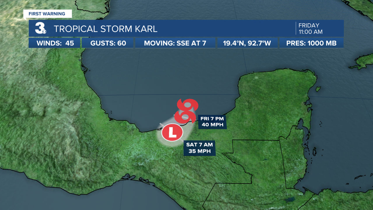
Tropical Storm Karl moving toward southern Mexico. On the forecast track, the center of Karl should reach the coast of southern Mexico late tonight or early Saturday. Data from an Air Force Reserve Hurricane Hunter aircraft indicate that maximum sustained winds are near 45 mph with higher gusts. Little change in strength is expected before the center of Karl reaches the coast. The system is forecast to dissipate over southern Mexico by Saturday night.

An area of disorganized showers and thunderstorms located several hundred miles south of the Cabo Verde Islands is associated with a tropical wave. Environmental conditions appear marginally conducive for some gradual development during the next few days while the system moves west and then WNW.
* Formation chance through 48 hours: Low (10%)
* Formation chance through 5 days: Low (20%)

Weather updates on social media:
Facebook: MylesHendersonWTKR
Twitter: @MHendersonWTKR
Instagram: @MylesHendersonWTKR


