


Meteorologist Myles Henderson’s First Warning Forecast
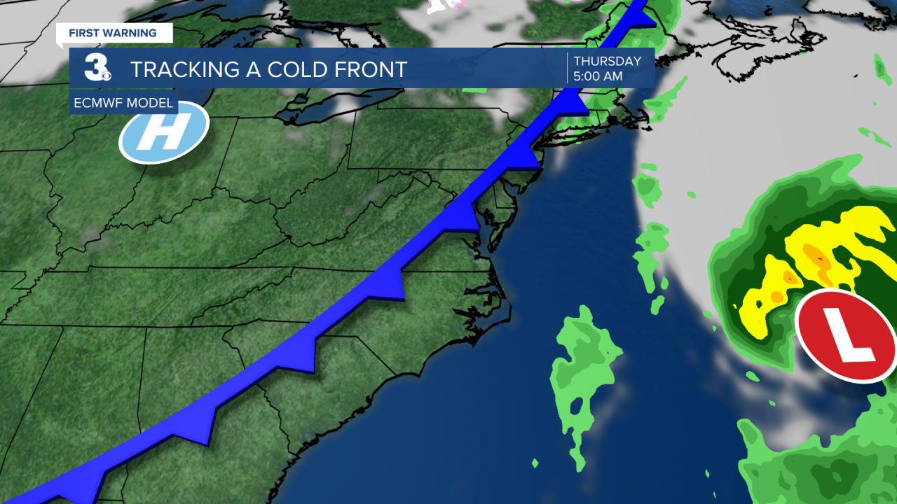
A sunny and warmer start to the week. Tracking a midweek cold front that will bring in cooler air.
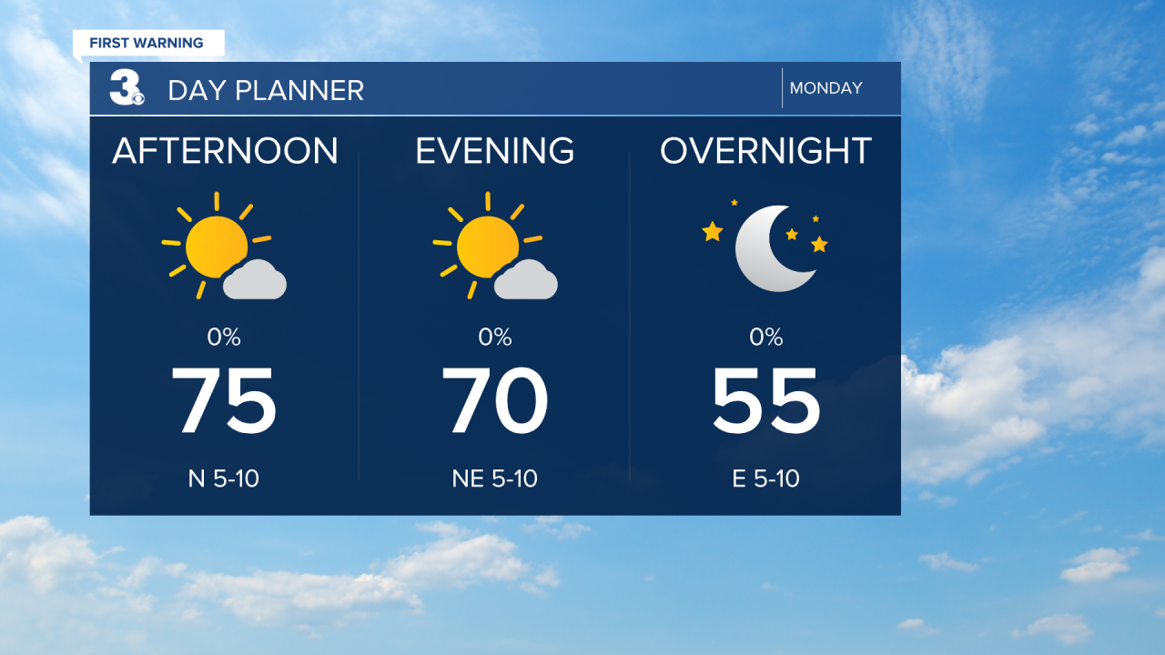
Lots of sunshine today with highs in the mid 70s, warmer than yesterday and above normal for this time of year.
Highs will climb into the upper 70s Tuesday and Wednesday with mostly sunny skies.
A cold front is set to move through early Thursday. Rain chances will be slim, but cooler air will move in behind the front. Highs will drop to the upper 60s for Thursday and Friday.
We are tracking another (mostly) dry cold front this weekend. Highs will warm back into the 70s on Saturday then fall to the mid 60s on Sunday.
Today: Mostly Sunny. Highs in the mid 70s. Winds: N 5-10
Tonight: Mainly Clear, Fog. Lows near 50. Winds: N 5-10
Tomorrow: Mostly Sunny. Highs in the upper 70s. Winds: N/E 5-10
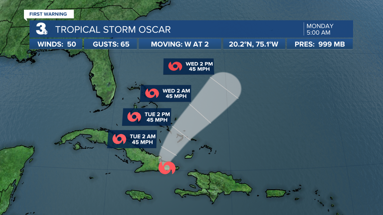
Tropical Update
Tropical Storm Oscar centered over eastern Cuba. On the forecast track, the center of Oscar is expected to emerge off the northern coast of Cuba late today or tonight and move near the southeastern and central Bahamas on Tuesday.
Maximum sustained winds have decreased to near 60 mph with higher gusts. Additional weakening is expected as Oscar interacts with the mountainous terrain of eastern Cuba, but Oscar could still be a tropical storm when it moves near the Bahamas on Tuesday.
Weather & Health
Pollen: Low (Ragweed, Grasses)
UV Index: 4 (Moderate)
Air Quality: Good (Code Green)
Mosquitoes: Moderate
Weather updates on social media:
Facebook: MylesHendersonWTKR
Instagram: @MylesHendersonWTKR
X (Twitter): @MHendersonWTKR
