Meteorologist Myles Henderson’s First Warning Forecast
A warm and muggy first half to the work week with highs near 90. Tracking a cold front for Thursday. Much cooler and less humid to end the week.
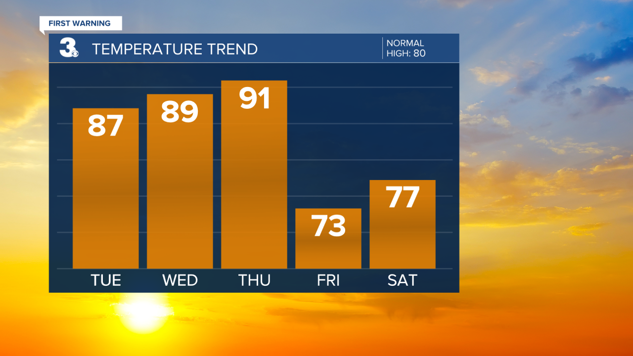
The last few days of summer will feel like summer. Expect highs in the upper 80s again today with more humidity. We will see mostly sunny skies with just a few clouds in the mix. Highs will return to the upper 80s on Wednesday with more sunshine.

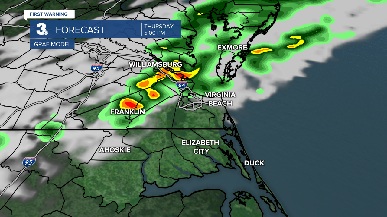
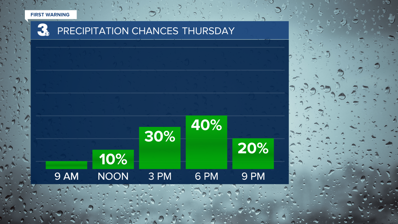
Changes move in with a cold front on Thursday. We will still be warm and humid ahead of the front, highs in the low 90s on Thursday. Expect scattered showers with an isolated thunderstorms possible, mainly Thursday afternoon to evening.

It will be much cooler and less humid behind the front. Highs will only reach the mid 70s on Friday and it will feel very fall-like. It will be windy on Friday with north winds at 10 to 20 and gusts to 30 mph.
Today: A Few Clouds. Highs in the upper 80s. Winds: W/N 5-10
Tonight: Mainly Clear. Lows in the mid 60s. Winds: E/S 5-10
Tomorrow: Mostly Sunny. Highs in the upper 80s. Winds: N/E 5-10
Weather & Health
Pollen: Medium (Ragweed)
UV Index: 6 (High)
Air Quality: Good (Code Green)
Mosquitoes: Very High
Tropical Update
Hurricane Fiona is centered just NNW of Grand Turk Island. On the forecast track, the center of Fiona will continue to move near the eastern Turks and Caicos during the next few hours, away from those islands by tomorrow, and approach Bermuda late Thursday. Maximum sustained winds remain near 115 mph with higher gusts. Fiona is a category 3 hurricane on the Saffir-Simpson Hurricane Wind Scale. Strengthening is forecast during the next couple of days.

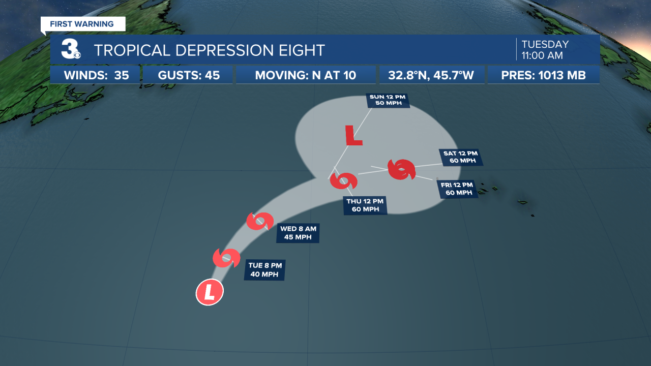
Tropical Depression Eight has formed over the north-central Atlantic Ocean. The depression is moving toward the north near 10 mph. A turn to the northeast is expected on Wednesday, followed by a motion to the east. Maximum sustained winds are near 35 mph with higher gusts. Slow strengthening is forecast, and the depression is expected to become a tropical storm later today or tonight.

Satellite data indicate that the tropical wave located several hundred miles east of the Windward Islands has become better organized this morning. Additional development is expected, and a tropical depression is likely to form within the next few days as the system moves west to WNW at 15 to 20 mph across the eastern and central Caribbean Sea.
* Formation chance through 48 hours: Medium (40%)
* Formation chance through 5 days: High (70%)

Weather updates on social media:
Facebook: MylesHendersonWTKR
Twitter: @MHendersonWTKR
Instagram: @MylesHendersonWTKR


