Meteorologist Myles Henderson’s First Warning Forecast
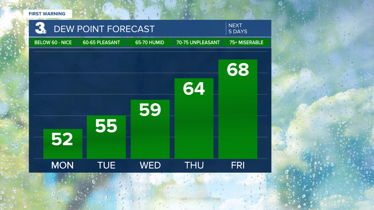
A return to fall-like weather to start the week. Humidity builds to end the week.
Very nice weather to kick off the work week. A cooler start this morning with temperatures in the 40s and 50s. Highs in the upper 70s today with low humidity and lots of sunshine.

Lots of sunshine with highs in the low 80s for Tuesday and Wednesday. Highs will remain in the low 80s but the humidity will start to build for the end of the week.

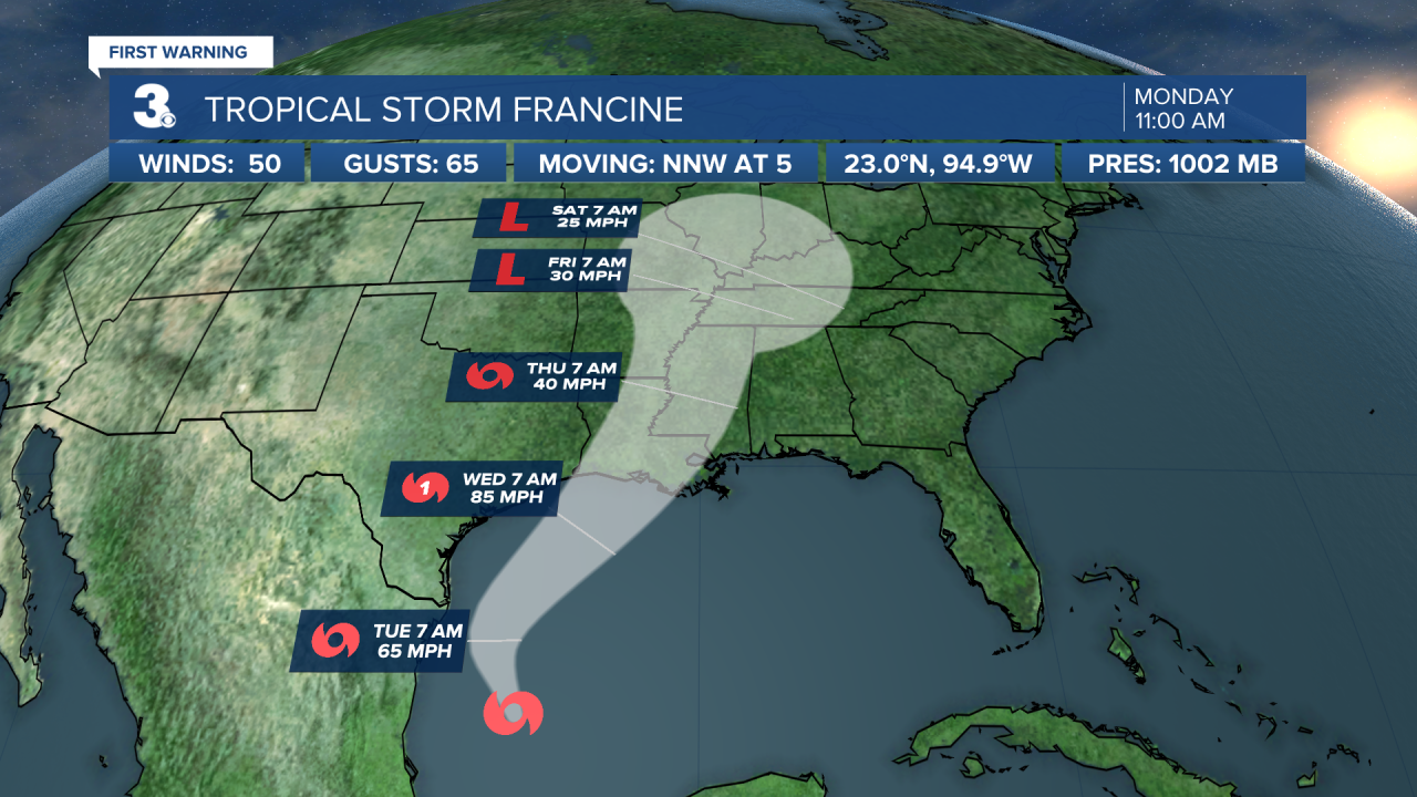
We are watching a developing tropical system in the Gulf of Mexico. It is forecast to make landfall near Louisiana/Texas by midweek. The leftover moisture from that system will likely spread across the southeast and could throw some rain our way by the end of the week or weekend.
Today: Sunny. Highs in the upper 70s. Winds: N/E 5-10
Tonight: Clear. Lows in the upper 50s. Winds: E/S 5-10
Tomorrow: Sunny. Highs in the low 80s. Winds: W/N/E 5-10
Tropical Update
Tropical Storm Francine forms over the Gulf of Mexico. On the forecast track, Francine is expected to approach the Louisiana and Upper Texas coastline on Wednesday.
Maximum sustained winds remain near 50 mph with higher gusts. Gradual intensification is expected over the next day with more significant intensification on Tuesday Night and Wednesday. Francine is expected to become a hurricane before it reaches the U.S. Gulf Coast on Wednesday.

Tracking two areas for potential development over the open Atlantic. Both systems could develop into a tropical depression by the middle to latter part of this week as they move generally west to NW.
Weather & Health
Pollen: Med-High (Ragweed)
UV Index: 7 (High)
Air Quality: Good (Code Green)
Mosquitoes: High
Weather updates on social media:
Facebook: MylesHendersonWTKR
Instagram: @MylesHendersonWTKR
X (Twitter): @MHendersonWTKR


