


Derrah Getter's First Warning Forecast
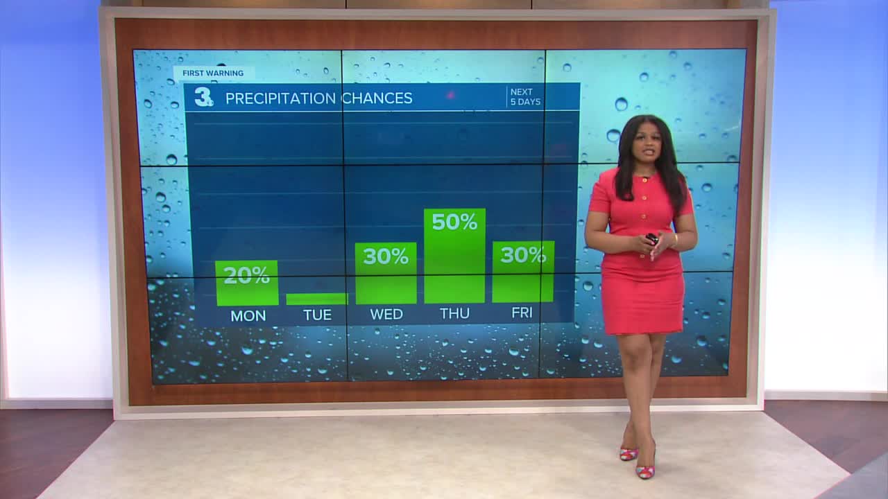
This evening a few isolated showers will be possible mainly for southern portions of our area. Skies clear as we head into Monday morning.
By Monday afternoon we'll be mostly sunny with highs in the low to mid 60s. The mild and dry conditions stick around for Tuesday and then temperatures go tumbling in the mid 40s by Wednesday.
Thursday is forecast to be our wettest and warmest day of the week with highs near 70 and scattered showers throughout the day. Temperatures trend closer toward average just in time for the following weekend.

Let's connect on social media!
Forecaster Derrah Getter:
For weather updates on Facebook: HERE
For weather updates on X: HERE
Follow me on Instagram: HERE
Check out the Interactive Radar on WTKR.com: Interactive Radar
