


Meteorologist Myles Henderson’s First Warning Forecast
A soggy start to Thursday. Back to the 60s to end the work week. Another big temperature swing this weekend.
Cloudy skies, patchy fog, drizzle, and showers to start the day. A round of moderate to heavy rain will move through mid-morning to midday. Showers will taper off off by the early afternoon with some clearing late in the afternoon. Temperatures will rebound to near 60 today and it will be breezy with a SW wind at 10 to 15 mph.

Friday looks like a nice day (for early February) with clearing skies and highs in the low to mid 60s.
Get ready for another big temperature swing this weekend. Highs will drop to the mid 40s on Saturday then return to the mid 60s on Sunday. Expect more clouds and showers on Saturday, more sunshine on Sunday.
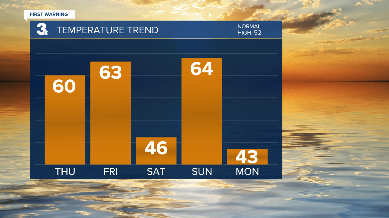
A chilly a soggy weather pattern locks in for next week. Expect several days with rain chances and highs in the 40s.
Today: Mostly Cloudy, Showers. Highs near 60. Winds: SW 5-15
Tonight: Partly Cloudy, Showers. Lows in the low 50s. Winds: SW 5-15
Tomorrow: Clearing Skies. Highs in the low 60s. Winds: N 5-10
Weather updates on social media:
Facebook: MylesHendersonWTKR
Instagram: @MylesHendersonWTKR
