Meteorologist Myles Henderson’s First Warning Forecast
Showers & storms today. Back to the sunshine for Friday and the weekend. Several days in the 60s and 70s.
Expect mostly cloudy to partly cloudy skies this afternoon with scattered showers possible. Another round of showers and storms will build in tonight as a cold front moves through. Some storms could be strong to severe.
Cooler air will move in behind the cold front. Highs will drop to the upper 60s on Friday. Clouds will clear out early in the morning, so most of the day will be sunny.
The upcoming weekend looks nice! Expect lots of sunshine on Saturday with highs in the low to mid 70s. Clouds will start to build in on Sunday with highs in the mid 70s.

Another cold front will move in on Monday bringing us another chance for showers and a big drop in temperatures for midweek.
Today: Showers & Storms. Highs in the mid 70s. Winds: S 10-15
Tonight: Scattered Showers. Lows in the mid 50s. Winds: W 5-15
Tomorrow: Mostly Sunny. Highs in the upper 60s. Winds: N 5-15
Weather & Health
Pollen: Low (Ragweed, Grasses)
UV Index: 1 (Low)
Air Quality: Good (Code Green)
Mosquitoes: High
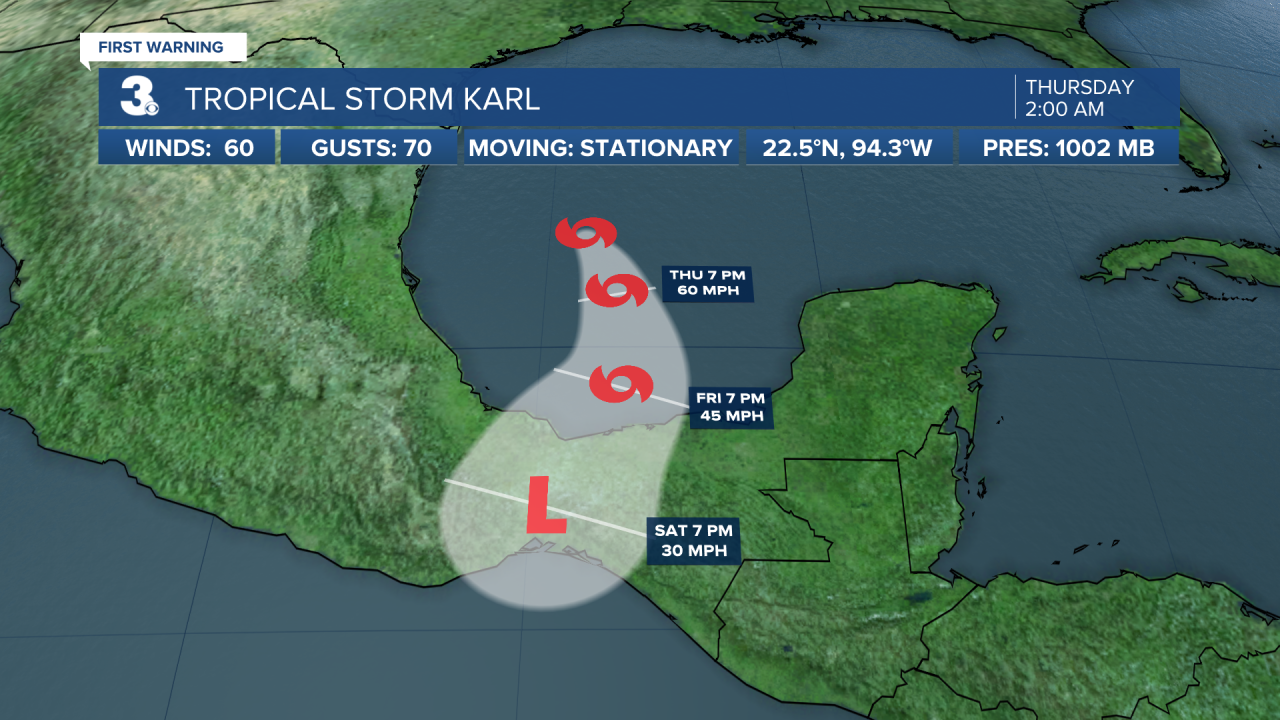
Tropical Update
Tropical Storm Karl lingering over the southwestern Gulf of Mexico. On the forecast track, the center of Karl should reach the coasts of Tabasco or Veracruz states in Mexico Friday night or early Saturday. Maximum sustained winds are near 60 mph with higher gusts. Little change in strength is expected today, but Karl should gradually lose some strength on Friday while it approaches the Bay of Campeche coast of Mexico.

A tropical wave located several hundred miles south of the Cabo Verde Islands is producing a broad area of showers and thunderstorms. Environmental conditions appear marginally favorable for some slow development of this system as it moves west to WNW over the tropical Atlantic through early next week.
* Formation chance through 48 hours: Low (0%)
* Formation chance through 5 days: Low (20%)

Weather updates on social media:
Facebook: MylesHendersonWTKR
Twitter: @MHendersonWTKR
Instagram: @MylesHendersonWTKR


