


Meteorologist Myles Henderson’s First Warning Forecast
Tracking rain and storms to end the workweek. Cool and breezy this weekend.
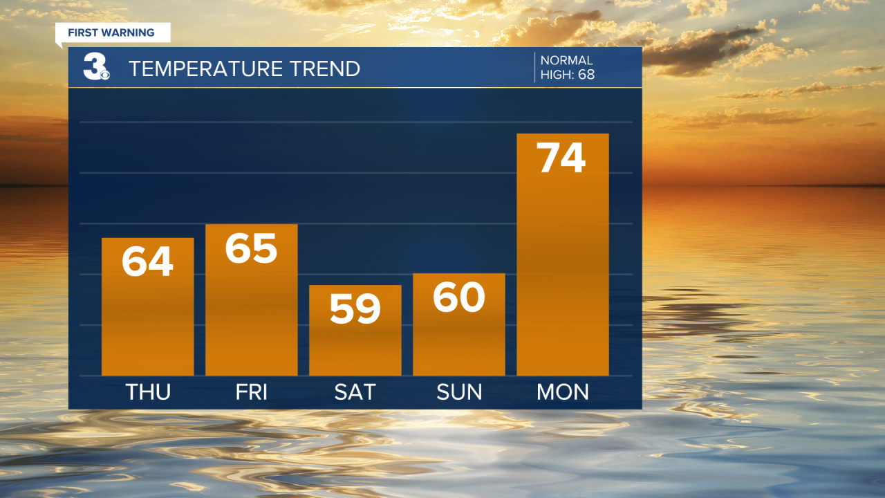
Another chilly start this morning with temperatures in the 30s and 40s. Highs will warm to the mid 60s today, closer to normal for this time of year. Look for building clouds today, mostly sunny this morning to mostly cloudy this afternoon.

Our next round of rain is set to move in with a cold front on Friday. Highs will remain in the mid 60s with mostly cloudy skies. Strong to severe thunderstorms are possible with localized flooding, strong wind gusts, and hail. As the cold front approaches, the wind will pick up, SW at 10 to 20 mph with higher gusts.

High temperatures will linger near 60 this weekend with a N/NW wind at 10 to 20 mph. Expect mostly cloudy skies with leftover showers on Saturday. More sunshine should mix in for Sunday.
Warming up early next week. Highs will climb to the mid 70s for Monday and Tuesday.
Today: Building Clouds. Highs in the mid 60s. Winds: SE 5-15
Tonight: Mostly Cloudy. Lows in the low 50s. Winds: SE 5-15
Tomorrow: Showers & Storms. Highs in the mid 60s. Winds: SE 10-20
Weather & Health
Pollen: High (Oak, Maple, Elm)
UV Index: 6 (Medium)
Air Quality: Good (Code Green)
Mosquitoes: Low
Weather updates on social media:
Facebook: MylesHendersonWTKR
Instagram: @MylesHendersonWTKR
