Meterologist Maddie Kirker's First Warning Forecast:
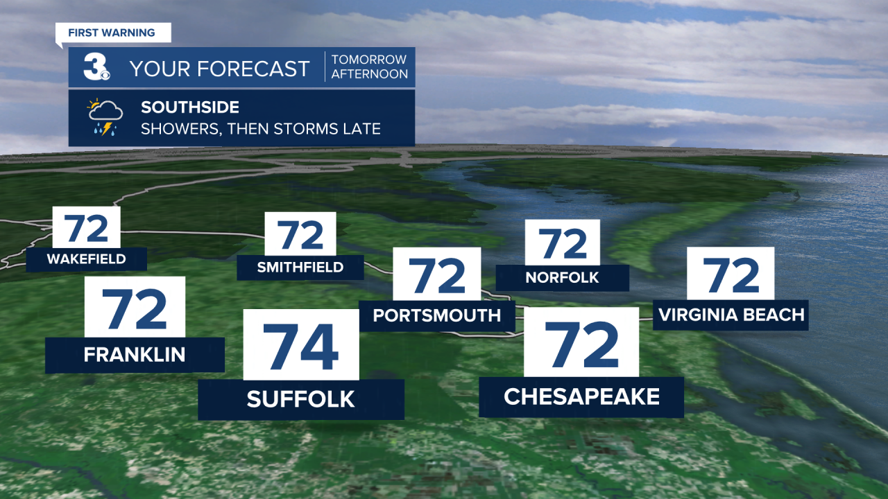
The dangerous storm system that has been tracking east across the deep south, will begin its arrival in our area starting Wednesday. We'll kick off the day dry but showers will build after lunchtime from west to east. It'll be nice and warm before the rain arrives, highs will be in the low to mid 70s.

Now let's talk severe weather potential and the timing. After sunset Wednesday is when the strongest part (highest energy) of the system will approach our area from west to east. With that, storms will be able to develop after midnight and continue to develop through Thursday morning to midday. This will be our window for severe weather and just like yesterday, the highest available storm energy Thursday morning will be across the Albemarle of North Carolina and southwest. (The graphic below is for between 8am Wednesday and 8am Thursday).

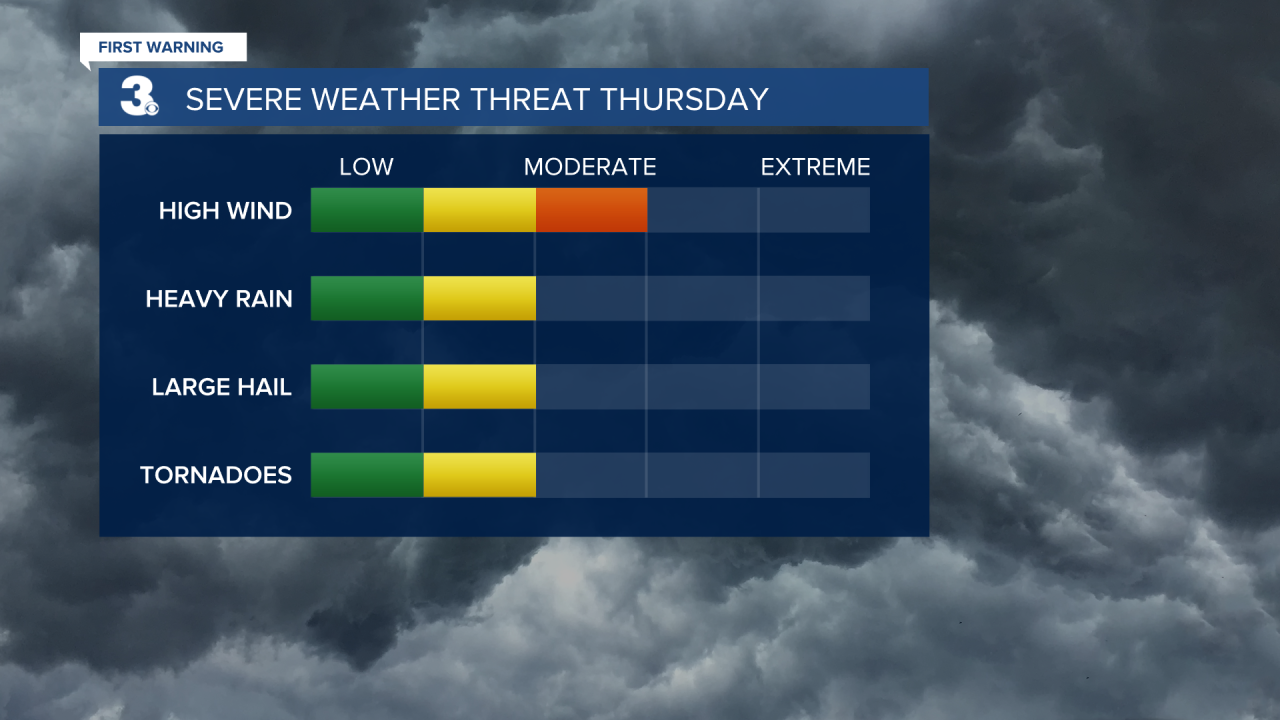
Below is our threat meter where you can obviously see that damaging winds is our biggest threat with any storms that develop. However, its important to note that the threat for heavy rain, hail and even tornadoes is not zero, so as you make your preparations it's important to know that pretty much anything is on the table. We've seen how this system has done all 4 over the past two days across the southwest and deep south.

This is a future radar snapshot of 9am Thursday. Latest high resolution models like this one favor storms, especially Thursday morning.

Once the system clears late Thursday afternoon, we will get a chance to dry out on Friday with highs falling to the mid 60s with partly cloudy skies. Even cooler air is set to move in this weekend with highs in the low 60s on Saturday and mid 50s on Sunday.


