

Derrah Getter's First Warning Forecast
It's been a warm and deceivingly quiet day but storm roll in tonight. A strong cold front will be the cause of the severe weather we could see. Our main concern will be damaging wind gusts but an isolated tornado can't be ruled out. The timing of the worst of the severe weather will be from around 8pm to midnight.
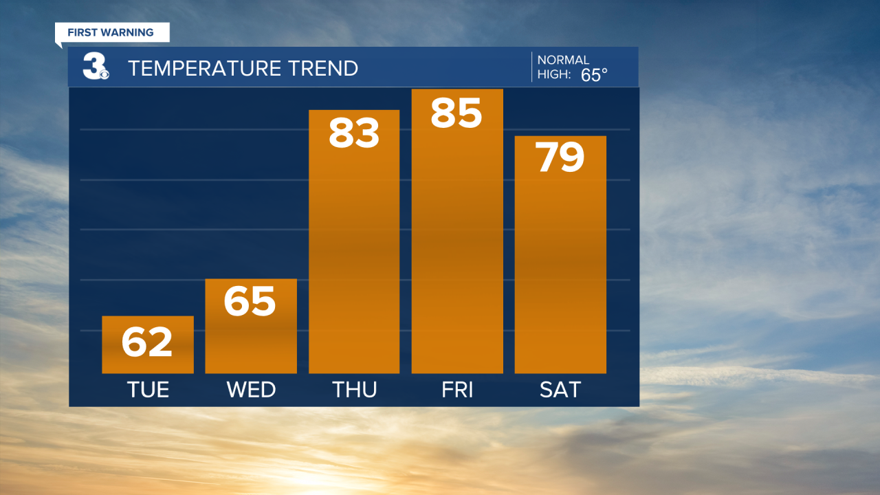
By the time most of us wake up Tuesday morning we'll be dry. Skies will be clearing throughout the day Tuesday and there will be a lot more sunshine during the afternoon. It will be much cooler with highs only in the low 60s.
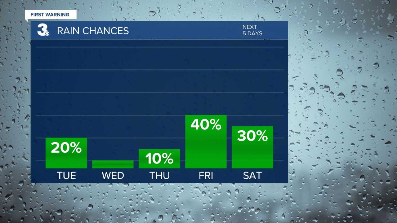
We're cool again Wednesday but warmer conditions return late-week. Rain chances slightly increase heading into the weekend as we ease back into an unsettled stretch of weather.


Let's connect on social media!
Forecaster Derrah Getter:
For weather updates on Facebook: HERE
For weather updates on X: HERE
Follow me on Instagram: HERE
Check out the Interactive Radar on WTKR.com: Interactive Radar
