Meteorologist Myles Henderson’s First Warning Forecast
*** Flood Watch in effect until midnight for parts of the Southside, Peninsula, and NE NC (mainly inland).

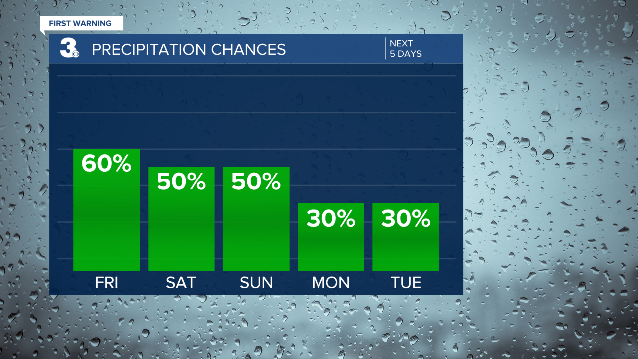
Showers and storms return for the end of the week and the weekend. Several days near 90 with a heat index near 100.
Don’t forget your umbrella, showers and storms are back. Another round of storms will fire up this afternoon to evening (2 pm to 8 pm). Strong to severe storms are possible with a risk of damaging wind gusts and localized flooding. Highs will try to reach 90 this afternoon, near normal for this time of year. It will feel more like 100 with the increased humidity.

We remain in a very summer-like weather pattern as we go through the weekend. Highs will linger in the low 90s with an afternoon heat index to 100+. Scattered showers and storms are possible both days (50% chance), mainly in the afternoons to evenings.

The trend continues for early next week. Highs in the low 90s but feeling like 100. Scattered showers and storms are possible, but lower chances (30%).
Today: Mix of Clouds, Scattered Storms. Highs near 90. Winds: SW 5-15
Tonight: Mix of Clouds, Scattered Storms. Lows in the mid 70s. Winds: SW 5-10
Tomorrow: Mix of Clouds, Scattered Storms. Highs near 90. Winds: S 5-10
Weather & Health
Pollen: Low (Grasses)
UV Index: 3 (Moderate)
Air Quality: Good (Code Green)
Mosquitoes: Extreme
Tropical Update
Subtropical Storm Don forms over the central Atlantic. A general motion to the north is expected during the next couple of days. A turn to the east is forecast on Sunday. Maximum sustained winds are near 50 mph with higher gusts. Gradual weakening is expected during the next few days.

Weather updates on social media:
Facebook: MylesHendersonWTKR
Twitter: @MHendersonWTKR
Instagram: @MylesHendersonWTKR


