Chief Meteorologist Patrick Rockey’s First Warning Forecast
Steamy, then stormy, then relief. That’s the short version of the weather week ahead.
Here’s the long version: High pressure will be dominating our weather for the next few days, bringing hot and dry conditions.

Expect high temperatures in the low-to-mid 90s Tuesday, Wednesday and Thursday.
It won’t be terribly muggy. But we will still have heat index values north of 100°.

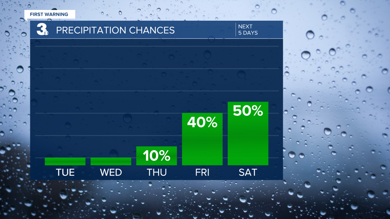
A cold front will push into the region on Friday, bringing increasing chances for showers and thunderstorms.
Rather than moving through, that cold front will linger across the region for a few days and be the focus for more showers and thunderstorms through the weekend.

Eventually, a second cold front will help push the first one out of here.
The increase in cloud cover and increased rain chances will help drop our temperatures into the 80s for the weekend.
And that second cold front means many of us may not get out of the 70s by next Monday! Stay tuned.


