


Meteorologist Myles Henderson’s First Warning Forecast
A warm week with highs in the 70s and 80s. Several chances for scattered showers and storms.
We will see a mix of partly to mostly cloudy skies with a spotty shower possible. Highs will reach the upper 70s today and the wind will pick up by midday.

Highs will reach the low 80s tomorrow with a mix of clouds. Scattered showers and storms are possible as a cold front moves into the region.
The front will stall out across the Carolinas on Wednesday, keeping a mix of clouds and scattered showers. Highs will drop to the low 70s on the north side of the front.

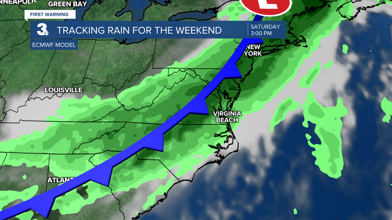
Thursday looks good with partly cloudy skies and highs in the low to mid 70s. Showers and storms will return for Friday and Saturday as another cold front moves in.
Today: Partly to Mostly Cloudy. Highs in the upper 70s. Winds: SE 5-15
Tonight: Partly Cloudy. Lows in the mid 60s. Winds: S 5-10
Tomorrow: Scattered Showers/Storms. Highs in the low 80s. Winds: SW 5-10
Weather & Health
Pollen: High (Trees)
UV Index: 5 (Medium)
Air Quality: Good (Code Green)
Mosquitoes: High
Weather updates on social media:
Facebook: MylesHendersonWTKR
Instagram: @MylesHendersonWTKR
