


Meteorologist Myles Henderson’s First Warning Forecast
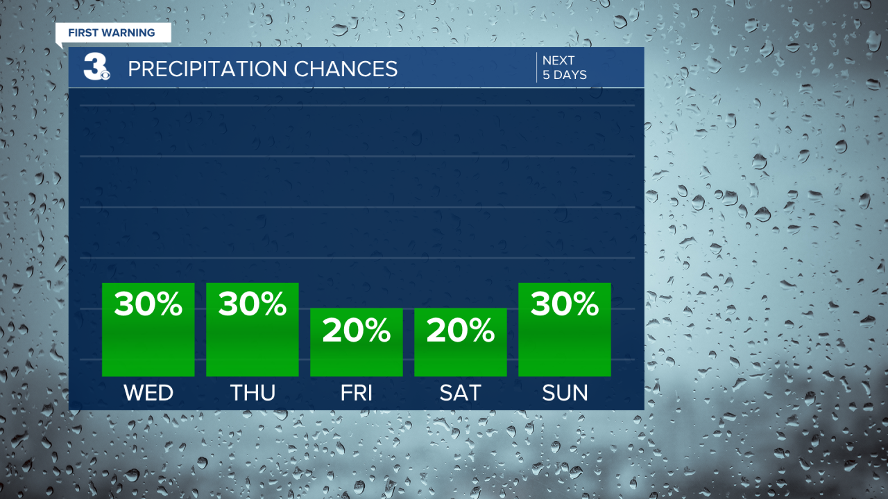
Smaller rain chances and not as windy to end the workweek. Wind conditions return for the weekend.
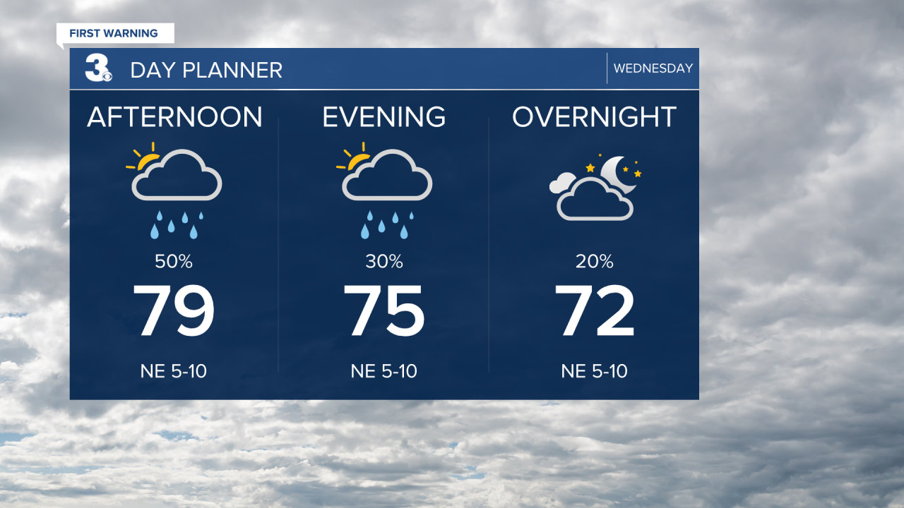
We will see a mix of partly to mostly cloudy skies today with scattered showers and an isolated storm possible. Winds will relax today but could still see some coastal flooding near times of high tide. Highs will reach the upper 70s to near 80 today.
A very similar picture for Thursday; mix of clouds, scattered showers, and light winds. More sunshine will mix in for Friday. Highs will return to the upper 70s to end the week.
The wind will kick up again this weekend, with gusts reaching 20 to 30 mph. Expect partly to mostly cloudy skies with scattered showers (20-30%) possible both days.
Today: Scattered Showers. Highs in the upper 70s. Winds: NE 5-10
Tonight: Scattered Showers. Lows in the upper 60s. Winds: NE 5-10
Tomorrow: Scattered Showers. Highs in the upper 70s. Winds: N 5-10
Tropical Update
Watching the remnants of Gordon over the central tropical Atlantic. Environmental conditions could become more conducive for development later this week, and a tropical depression or storm could re-form in a few days while the system moves over the central subtropical Atlantic.
* Formation chance through 48 hours: Low (30%)
* Formation chance through 7 days: Medium (60%)
Weather & Health
Pollen: Low (Ragweed)
UV Index: 4 (Medium)
Air Quality: Good (Code Green)
Mosquitoes: Very High
Weather updates on social media:
Facebook: MylesHendersonWTKR
Instagram: @MylesHendersonWTKR
X (Twitter): @MHendersonWTKR
