


Meteorologist Myles Henderson’s First Warning Forecast
Rain, wind, and a severe storm threat today. A nice end to the work week and weekend.
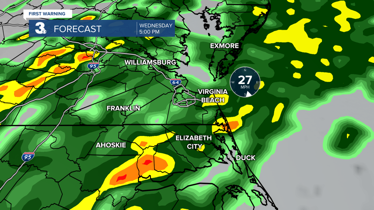
Rain returns today as an area of low-pressure moves from the South to the Northeast. A few showers are possible this morning, but the widespread rain will build in around midday. Expect rain and storms through the afternoon to evening. Rain could be heavy at times with a risk for strong to severe storms. The greatest severe risk is in NC. Winds will crank up through the day, SE at 15 to 25 with gusts to 35 mph. Temperatures will climb to the low and mid 60s this evening.
Rain will move out overnight and skies will clear out very early Thursday. It will still be windy tomorrow with west winds at 10 to 20 and gusts to 30 mph. Highs will drop back to the low 50s.
Highs will fall to the upper 40s on Friday, the coolest day of the week. We will see mostly sunny skies with light winds.
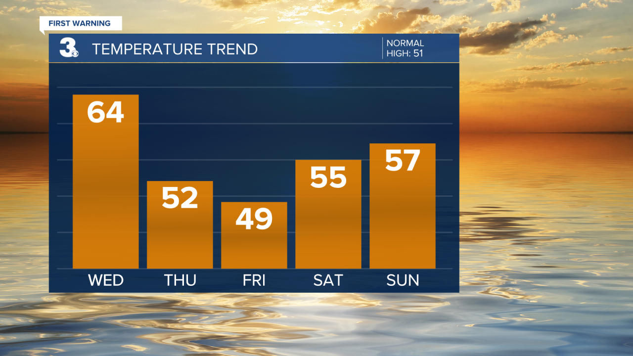
We will climb back to the mid and upper 50s this weekend. Expect mostly sunny skies on Saturday with clouds building in on Sunday.
Today: Rain, Storms, Windy. Highs in the mid 60s. Winds: SE/S 15-25G35
Tonight: Clearing Overnight, Windy. Lows in the mid 40s. Winds: S/SW 15-25G35
Tomorrow: Sun & Clouds, Windy. Highs in the low 50s. Winds: W 10-20G30
Weather updates on social media:
Facebook: MylesHendersonWTKR
Twitter: @MHendersonWTKR
Instagram: @MylesHendersonWTKR
