


Meteorologist Myles Henderson’s First Warning Forecast
Soggy and windy today. Smaller rain chances and not as windy to finish up the workweek.
Cloudy skies today with several rounds of showers and storms moving through from SE to NW. Rain could be heavy at times and localized flooding is possible. It will be windy again today, ENE at 10 to 20 with gusts to 25 mph. The strong winds could trigger coastal flooding near times of high tide.

Winds will back down for the second half of the week. Expect a mix of clouds with scattered showers lingering throughout the week. High temperatures will stay in the upper 70s to low 80s.
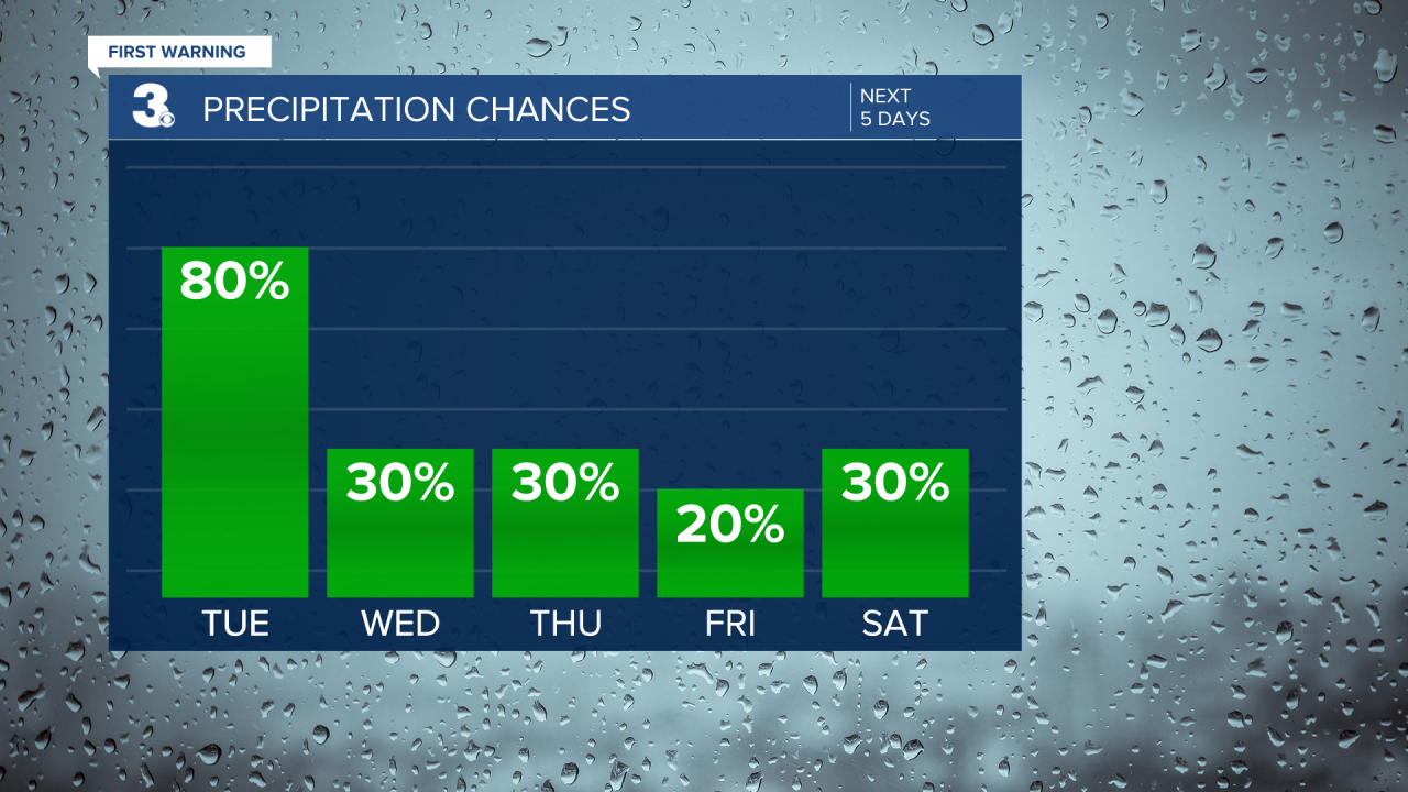
The wind will kick up again this weekend, with gusts 20 to 30 mph. Expect partly to mostly cloudy skies with scattered showers possible both days.
Today: Rain & Windy. Highs in the mid 70s. Winds: E 10-20 G25
Tonight: Showers. Lows near 70. Winds: E 10-20
Tomorrow: Scattered Showers. Highs near 80. Winds: NE 5-10
Tropical Update
Tropical Depression Gordon over the central Atlantic. A turn toward the north is expected during the next day or so. Gordon could gradually re-intensify by midweek and become a tropical storm again.
Weather & Health
Pollen: Low (Ragweed)
UV Index: 1 (Low)
Air Quality: Good (Code Green)
Mosquitoes: Very High
Weather updates on social media:
Facebook: MylesHendersonWTKR
Instagram: @MylesHendersonWTKR
X (Twitter): @MHendersonWTKR
