


Meteorologist Myles Henderson’s First Warning Forecast
Rain, storms, and wind from the outer bands of Helene. Some clearing for the weekend.
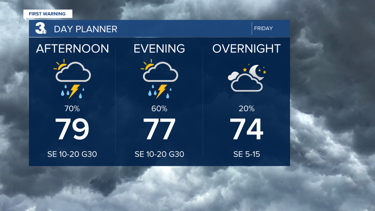
Our rain and storm chances will go up this afternoon to evening as the outer bands of Helene stretch across the Mid-Atlantic. Rain could be heavy at times with strong to severe thunderstorms possible including a tornado risk. Winds will kick up today, mainly SE at 10 to 20 with gusts to 30 mph.
Showers should clear out overnight and we will see partly cloudy skies this weekend. Highs will reach the mid 80s on Saturday and low 80s on Sunday with lighter winds. Our next round of showers moves in Sunday to early next week as the remnants of Helene slide east.

Today: Showers & Storms. Highs in the upper 70s. Winds: SE 10-20 G30
Tonight: Mostly Cloudy. Lows near 70. Winds: SE 10-20
Tomorrow: Partly Cloudy. Highs in the mid 80s. Winds: S 5-10
Tropical Update
Tropical Storm Helene in producing catastrophic flooding over portions of the southeast and southern Appalachians. Helene is forecast to stall over the Tennessee Valley tonight and through the weekend.
Maximum sustained winds have decreased to near 45 mph with higher gusts. Continued weakening is expected, and Helene is forecast to become extratropical later today.
Tropical-storm-force winds extend outward up to 345 miles east of the center.

Hurricane Isaac heading east over the north central Atlantic. An east to ENE motion is expected over the next several days. Additional strengthening is expected during the next day or so followed by gradual weakening by the end of this weekend.
Tropical Storm Joyce forms over the central tropical Atlantic. A northwest to north motion is expected over the next few days. Gradual strengthening is expected through Saturday, followed by gradual weakening early next week.

Weather & Health
Pollen: Low (Ragweed)
UV Index: 1 (Low)
Air Quality: Good (Code Green)
Mosquitoes: Very High
Weather updates on social media:
Facebook: MylesHendersonWTKR
Instagram: @MylesHendersonWTKR
X (Twitter): @MHendersonWTKR
