


Meteorologist Myles Henderson’s First Warning Forecast
More humidity to end the week. A few showers this weekend, but more rain to start next week.
Building clouds today with highs near 80 and more humidity. NE winds will start to pick up, 5 to 15 mph.

More humidity with highs in the upper 70s on Friday. Expect a mix of partly to mostly cloudy skies with an isolated shower possible.
Highs will linger in the upper 70s this weekend and it will still be humid. Expect partly cloudy skies with isolated showers possible both days. NE winds will also kick up this weekend, reaching 10 to 20 mph.
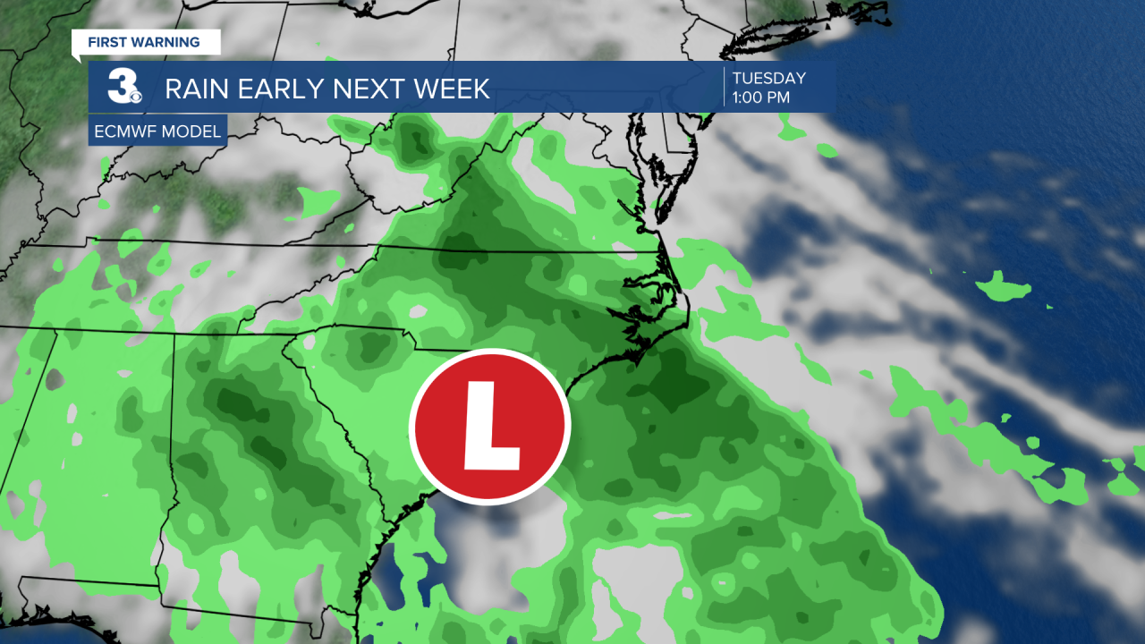
Rain chances will increase early next week as an area of low pressure lingers along the Carolina coast. Expect a cloudy, soggy, and windy first half of the week.
Today: Building Clouds. Highs near 80. Winds: NE 5-15
Tonight: Mix of Clouds. Lows in the upper 60s. Winds: NE 5-15
Tomorrow: Mix of Clouds. Highs in the upper 70s. Winds: NE 10-15
Tropical Update
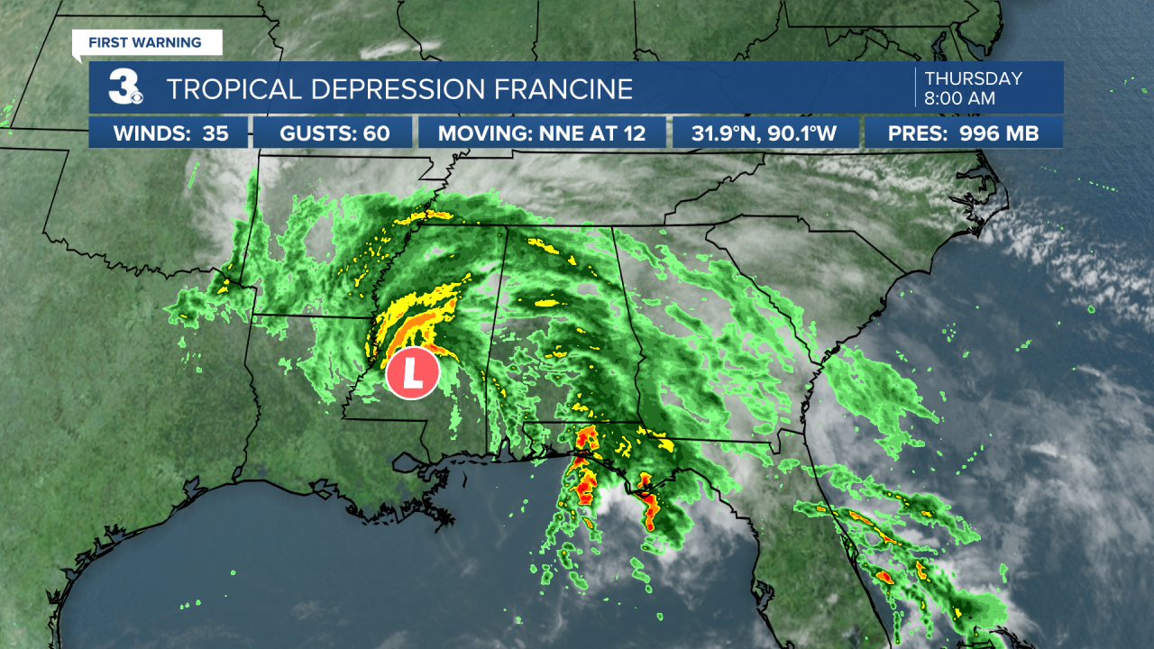
Francine weakens to a tropical depression over Mississippi. A slower motion NNE to north is expected during the next couple of days. Francine is expected to become a post-tropical cyclone by tonight.
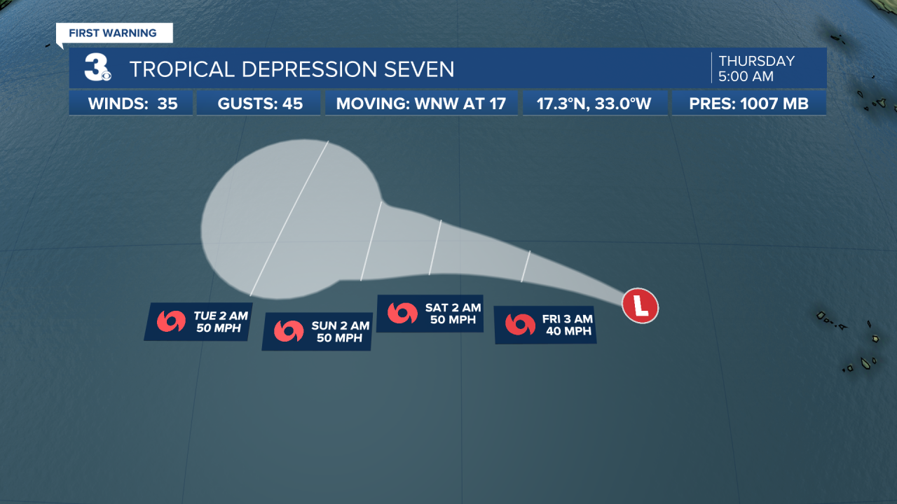
Tropical Depression Seven is expected to become Tropical Storm Gordon soon. A west to WNW motion is anticipated over the next few days. Maximum sustained winds are near 35 mph with higher gusts. Some strengthening is forecast during the next 48 hours, and the depression could become a tropical storm on Thursday.
Weather & Health
Pollen: Med-High (Ragweed)
UV Index: 7 (High)
Air Quality: Good (Code Green)
Mosquitoes: Very High
Weather updates on social media:
Facebook: MylesHendersonWTKR
Instagram: @MylesHendersonWTKR
X (Twitter): @MHendersonWTKR
