


Meteorologist Myles Henderson’s First Warning Forecast
Building heat and humidity. More chances for showers and storms through the work week.
Warming to near 90 today with an afternoon heat index near 100. Expect partly cloudy skies this morning to midday with clouds, showers, and storms building this afternoon to evening.

A very similar day on Wednesday. Highs near 90 with a heat index near 100. A mix of clouds with showers and storms building in the afternoon to evening.
Expect mostly cloudy skies on Thursday with a bigger chance for showers and storm throughout the day. Highs will drop to the mid 80s, but it will still be humid.
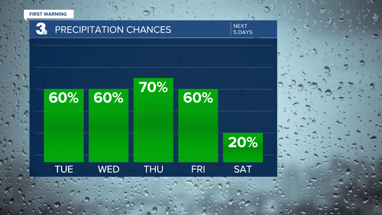
A cold front is set to move through on Friday, helping to reset our weather pattern. Rain chances will drop for the weekend, with more sunshine. Highs will settle in the low to mid 80s with a dip in humidity behind the front.
Today: Mix of Clouds, PM Storms. Highs near 90. Winds: SW 5-10
Tonight: Scattered Storms. Lows in the mid 70s. Winds: SW 5-10
Tomorrow: Mix of Clouds, PM Storms. Highs in the upper 80s. Winds: SW 5-15
Tropical Update
No tropical activity at this time
Weather & Health
Pollen: Low-Medium (Grasses)
UV Index: 8 (High)
Air Quality: Good (Code Green)
Mosquitoes: Extreme
Weather updates on social media:
Facebook: MylesHendersonWTKR
Instagram: @MylesHendersonWTKR
X (Twitter): @MHendersonWTKR
