

Derrah Getter's First Warning Forecast
This evening, we'll be cooling down into the 60s. Building clouds preventing temperatures from dropping as low. Early Saturday morning, fewer locations could reach the 50s. Some patchy fog could develop but will quickly burn off once the sun comes up. Highs Saturday will warm to the upper 70s.
There will be plenty of sunshine both weekend days. A stronger cold front approaches at the beginning of next week. Temperatures to begin the week will be in the low 70s. by the middle of next week we could see highs only in the upper 60s with lows in the 40s and 50s.

Tropical Update
As of 10/4/24, 5 pm:

Hurricane Kirk is currently a major hurricane. While it won't directly impact us here at home, it could lead to some rough surf.
Tropical Storm Leslie is expected to strengthen into a hurricane as it continues drifting westward over the Atlantic.
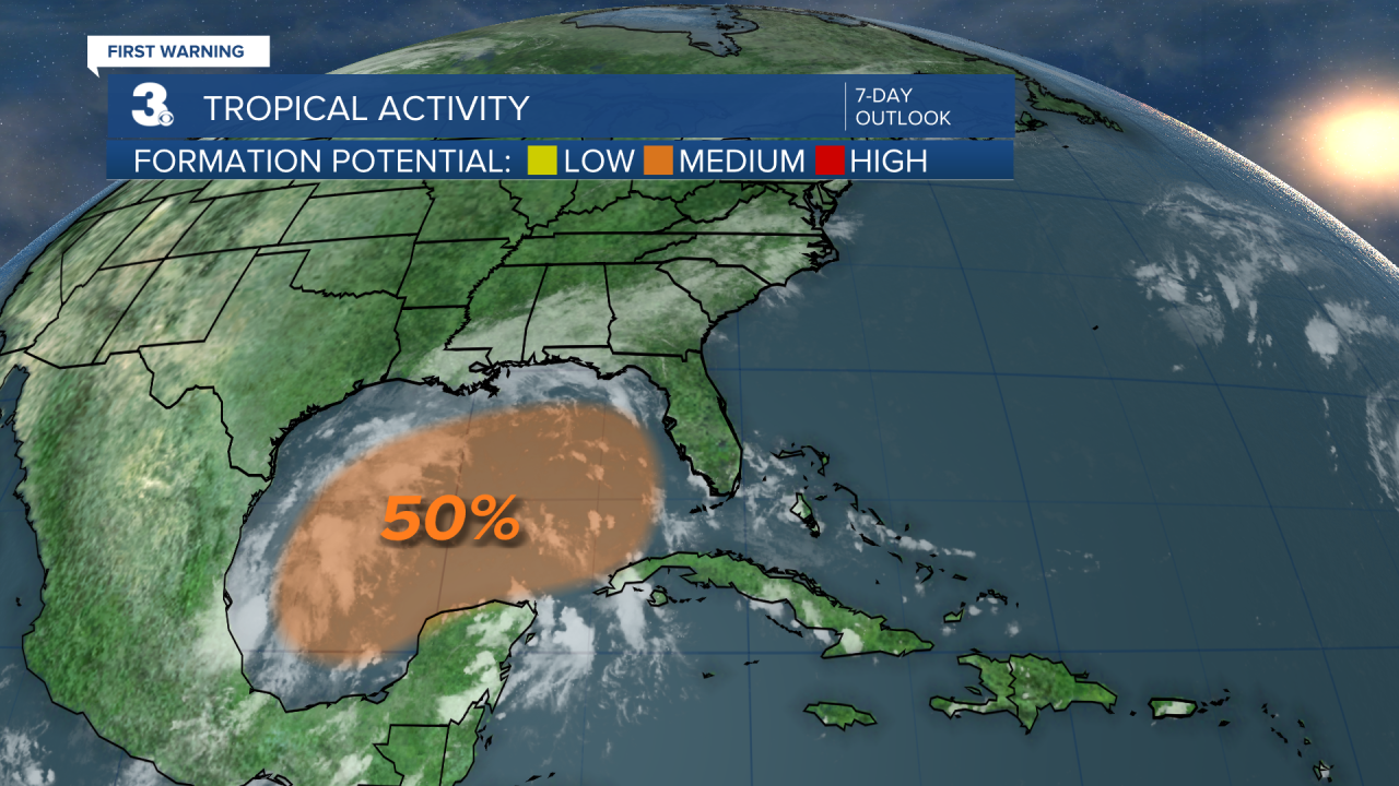
Confidence in the development of some moisture in the Gulf has been increased from a low chance (30%) back to a medium chance (50%).
Let's connect on social media!
Forecaster Derrah Getter:
For weather updates on Facebook: HERE
For weather updates on Twitter: HERE
Follow me on Instagram: HERE
Check out the Interactive Radar on WTKR.com: Interactive Radar
