


Sunday Weather Update from Meteorologist Kristy Steward:
We are in for a wild Sunday. It will be windy all day with sustained SSW winds 20-35 MPH gusting to 50-60 MPH. That could cause power outages and trees in super-saturated grounds to fall. It will also be difficult for high-profile vehicles to drive at times. Everyone is under a High Wind Warning from 9AM-3PM Sunday.
Everyone is also under a Level 1 of 5 risk for severe storms. Damaging winds are the main threat, but localized flooding and a brief spin-up tornado are also possible as this line of storms pushes through. Storms enter our inland communities around 10AM, Southside/Peninsulas around Noon, and OBX around 1-2PM. Storms should clear out for all by 3PM. Just a few spotty showers, clearing clouds, and falling temps after.
Derrah Getter's First Warning Forecast
This evening showers continue pushing through. The rain tapers off briefly before another round arrives overnight. Gusty conditions are forecast Sunday and with an already moist ground, power lines and trees will become more susceptible to wind damage.
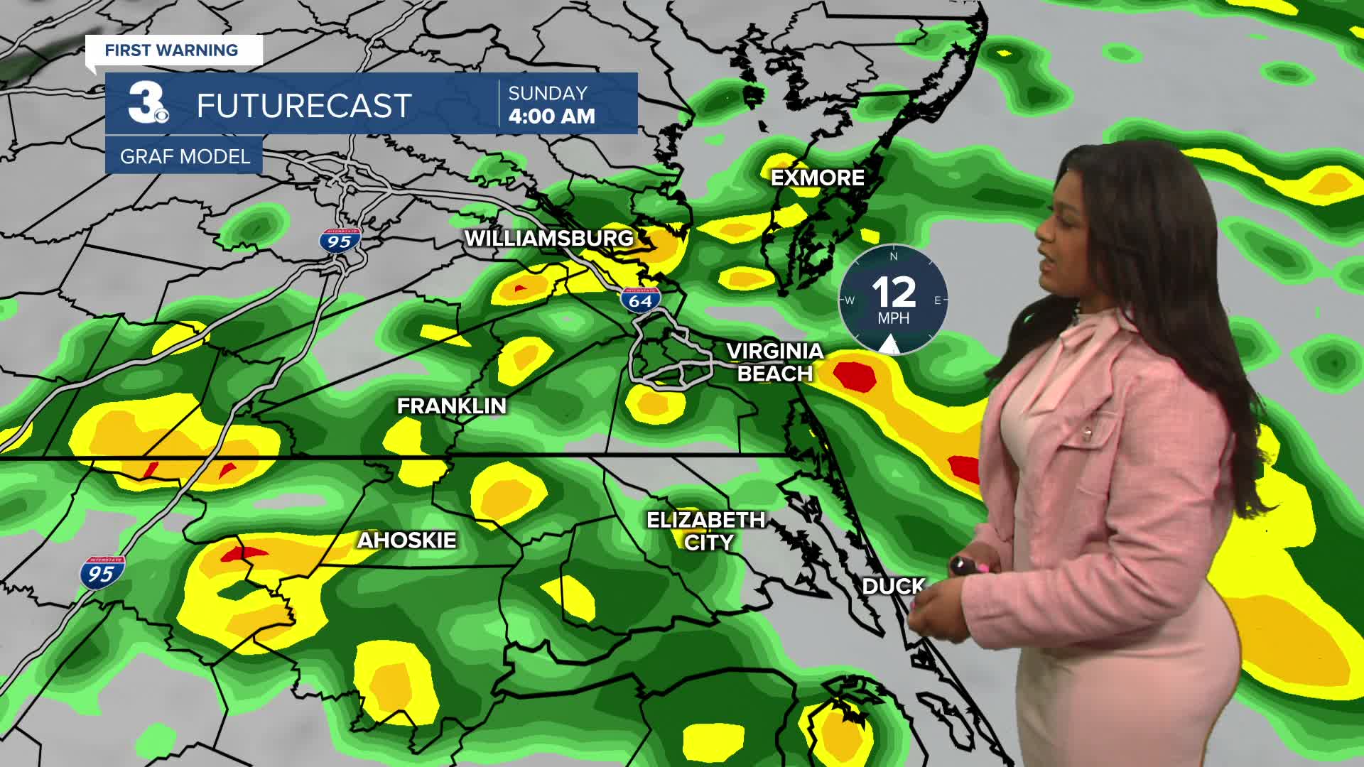
Early Sunday morning some showers and thunderstorms move through as winds begin to pick up. Wind gusts are forecast to hold at around 40 miles per hour throughout the day. Another line of storms moves through during the afternoon. A level 1 out of 5 severe weather threat is in place with the primary concern being damaging wind gusts. The rain fades late Sunday evening and sunshine returns for Presidents' Day on Monday.
Next week features another chance for a wintry mix. Late Wednesday and into Thursday morning another system moves through bringing us our next round of potentially a rain and snow mix. Temperatures will hover in the mid to upper 30s.

Let's connect on social media!
Forecaster Derrah Getter:
For weather updates on Facebook: HERE
For weather updates on X: HERE
Follow me on Instagram: HERE
Check out the Interactive Radar on WTKR.com: Interactive Radar
