


Chief Meteorologist Patrick Rockey’s First Warning Forecast
A powerful cold front spawned damaging wind gusts, life-threatening flooding, grapefruit sized hail and dangerous tornadoes across much of Virginia and North Carolina on Monday evening.
Just not our part of Virginia and North Carolina. Our region experience what has come to be known as the "Mid Atlantic Split." That's when a line of storms splits in two, leaving our region unscathed. And I'm not complaining.
Behind the cold front that brought the storms, we won’t see a dramatic drop in temperatures. Most of us will be 3-5° less hot on Tuesday and Wednesday. But we will see a welcome drop in humidity levels.
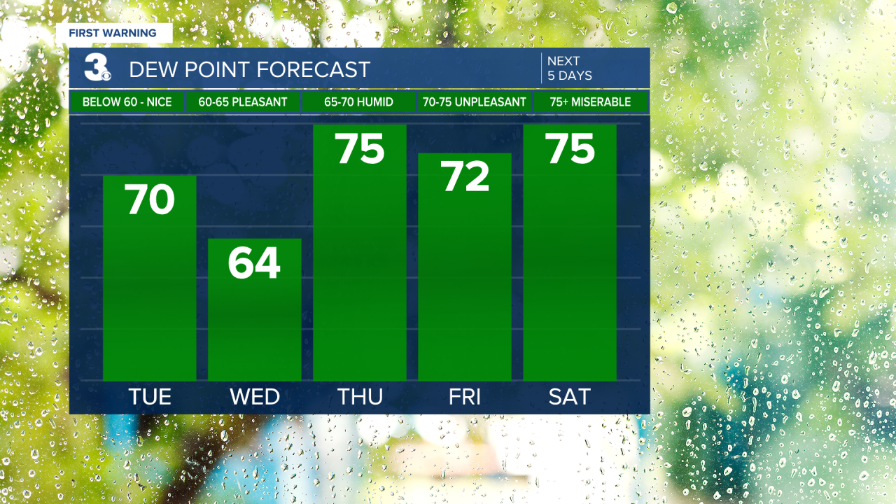
You may not notice a huge difference when you step out the door on Tuesday morning, but the drier air should move in by Tuesday afternoon and you’ll really feel the difference on Wednesday.
But the heat and humidity will return in a big way by Thursday, bringing another chance for thunderstorms.
And then we settle back into our typical August pattern, with heat humidity, and a chance for thunderstorms just about every day through the weekend. Stay tuned.
