Meteorologist Myles Henderson’s First Warning Forecast
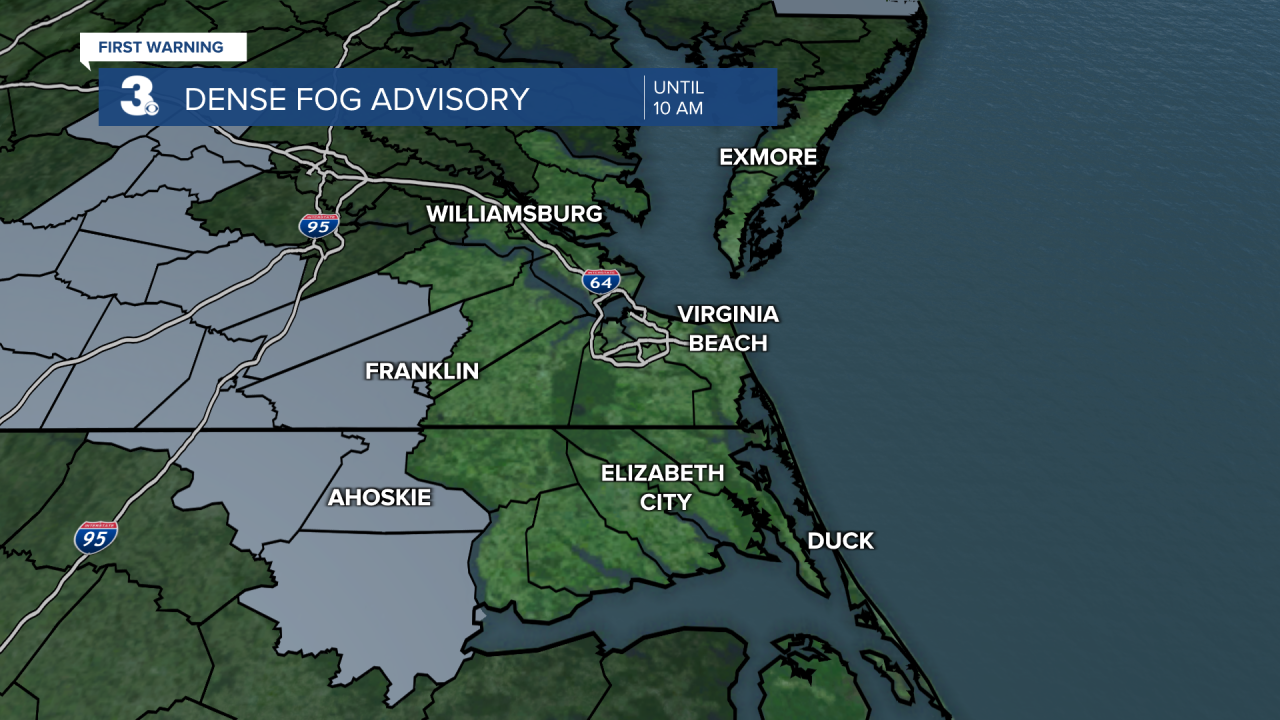
*** Dense Fog Advisory until 10 AM for Franklin, Southampton, Sussex, Hertford, Bertie, Northampton.

A gloomy first half of the week. Cooler and windy to end the week. Tracking rain chances for the weekend and Halloween.
Watch out for areas of dense fog this morning, mainly inland. We will see mostly cloudy to partly cloudy skies today with a spotty shower or drizzle possible. Highs will warm to the upper 60s, near normal for this time of year.
Highs will warm to the mid 70s on Wednesday, the warmest day of the week. We will still see a mix of clouds with a spotty shower possible. A cold front will move through Wednesday night. Rain chances will be limited but colder air will follow.

We will see more sunshine on Thursday, but it will be cooler with highs in the mid to upper 60s. Winds will also start to pick up, north at 10 to 15 mph. Highs will remain in the mid to upper 60s for Friday and the weekend. Persistent NE winds will continue with building clouds.
Showers are possible for the weekend and Halloween as we will be stuck between a cold front moving in from the west and an area of low pressure lingering off the East Coast.

Today: Mix of Clouds, Spotty Showers. Highs in the upper 60s. Winds: N 5-10
Tonight: Mix of Clouds, Patchy Fog. Lows in the mid 50s. Winds: E 5-10
Tomorrow: Mix of Clouds, Spotty Showers. Highs in the mid 70s. Winds: S 5-10
Weather & Health
Pollen: Low (Ragweed, Grasses)
UV Index: 5 (Moderate)
Air Quality: Good (Code Green)
Mosquitoes: High
Tropical Update
Showers and thunderstorms have decreased since yesterday in association with a well-defined area of low pressure located just WNW of Bermuda. Environmental conditions are becoming less conducive for development, and the chance of this system becoming a short-lived tropical depression appears to be decreasing.
* Formation chance through 48 hours: Medium (40%)
* Formation chance through 5 days: Medium (40%)
An area of low pressure is expected to form midway between Puerto Rico and Bermuda in a couple of days. Environmental conditions appear conducive for gradual subtropical development of this system while it meanders over the southwestern Atlantic through the weekend.
* Formation chance through 48 hours: Low (0%)
* Formation chance through 5 days: Low (30%)
An area of low pressure could form over the eastern Caribbean Sea by early this weekend. Environmental conditions are forecast to be conducive for gradual development as the low drifts west or WNW over the eastern Caribbean this weekend.
* Formation chance through 48 hours: Low (0%)
* Formation chance through 5 days: Low (20%)
Weather updates on social media:
Facebook: MylesHendersonWTKR
Twitter: @MHendersonWTKR
Instagram: @MylesHendersonWTKR


