


Meteorologist Myles Henderson’s First Warning Forecast
Near normal temperatures with building humidity through the week.
Lots of sunshine again today with highs in the low to mid 80s, near normal for this time of year.

Highs will remain in the low 80s but the humidity will start to build for the end of the week. We will also see more clouds mix in with an isolated shower possible to end the work week.
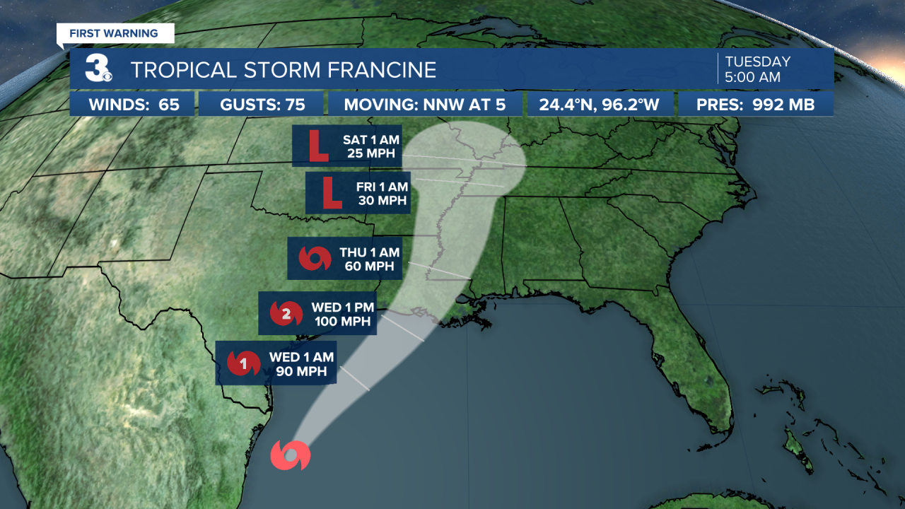
We are tracking a tropical system in the Gulf of Mexico (Francine). It is forecast to make landfall near Louisiana on Wednesday. The leftover moisture from that system will likely spread across the southeast and could throw some rain our way by the end of the week or weekend.
Today: Sunny. Highs in the low 80s. Winds: W/N/E 5-10
Tonight: Clear. Lows in the low 60s. Winds: E/S 5-10
Tomorrow: Mostly Sunny. Highs in the low 80s. Winds: W/N/E 5-10
Tropical Update
Tropical Storm Francine continues moving slowly north, just off the Mexico Gulf coast. On the forecast track, Francine is anticipated to be just offshore of the coasts of northeastern Mexico and southern Texas through today and make landfall in Louisiana on Wednesday. Maximum sustained winds remain near 65 mph with higher gusts. Francine will likely become a hurricane today, with significant strengthening expected before it reaches the coast.
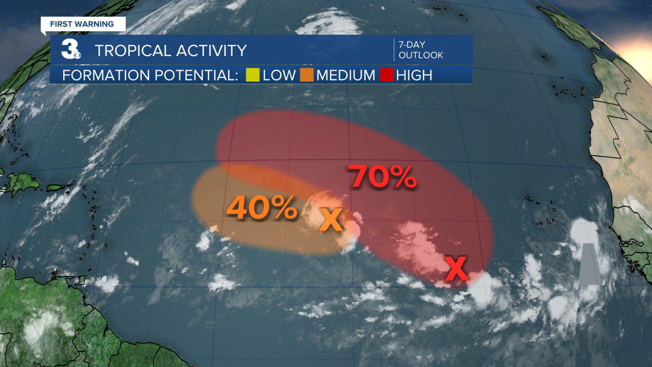
Tracking two areas for potential development over the open Atlantic. Both systems could develop into a tropical depression by the middle to latter part of this week as they move generally west to NW.
Weather & Health
Pollen: Med-High (Ragweed)
UV Index: 7 (High)
Air Quality: Good (Code Green)
Mosquitoes: High
Weather updates on social media:
Facebook: MylesHendersonWTKR
Instagram: @MylesHendersonWTKR
X (Twitter): @MHendersonWTKR
