


Meteorologist Myles Henderson’s First Warning Forecast
Even cooler to end the work week. Warming up again this weekend.
Cool and breezy today. Highs will only reach the mid 60s, about 10 degrees below normal for this time of year. We will start with clouds in the morning, but skies will clear through the day from NW to SE. It will be windy with a north wind at 10 to 20 mph.

Lots of sunshine on Friday with highs in the upper 60s and light winds.
Warmer air returns for the weekend with highs in the upper 70s to near 80 with lots of sunshine. Another cool down is set to move in early next week behind a cold front. Rain chances remain slim.

Today: Clearing Skies, Breezy. Highs in the mid 60s. Winds: N 10-20
Tonight: Mainly Clear. Lows in the mid 50s. Winds: NE 5-15
Tomorrow: Sunny Skies. Highs in the upper 60s. Winds: N 5-10
Tropical Update
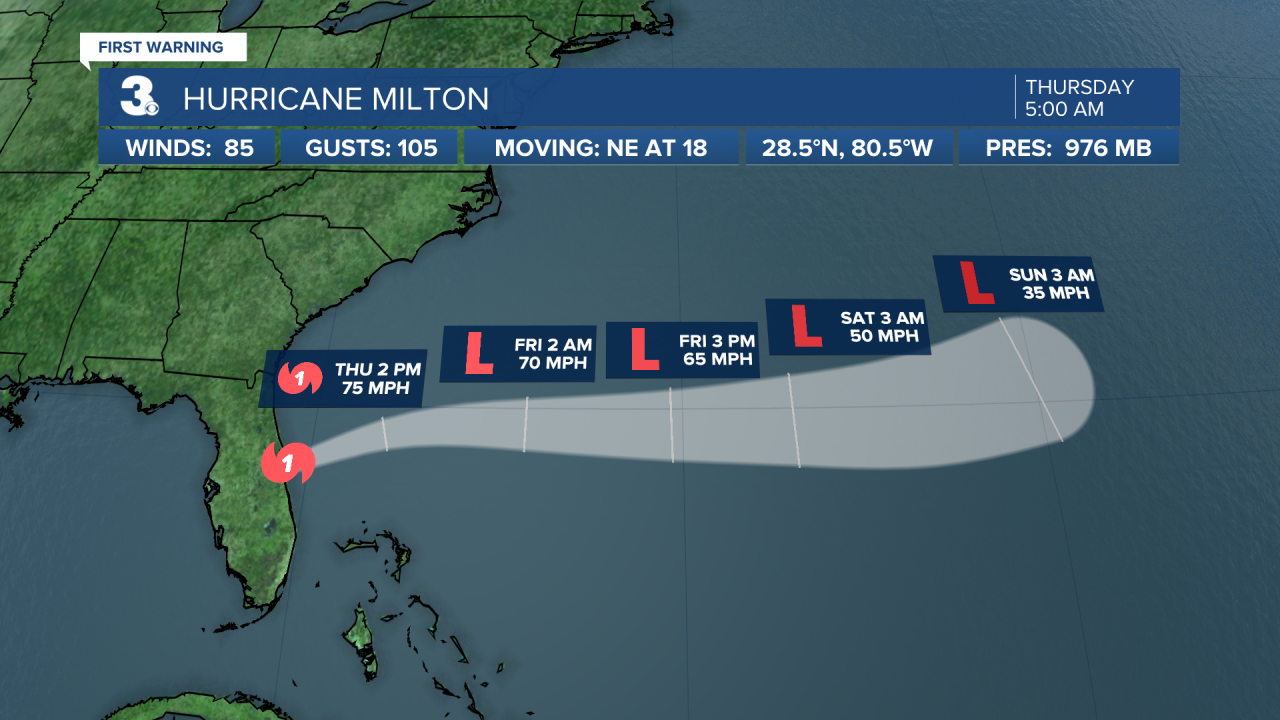
Hurricane Milton moving off the Florida east coast. On the forecast track, the center of Milton will move away from Florida and to the north of the Bahamas today. Maximum sustained winds are near 85 mph with higher gusts. Gradual weakening is expected, but Milton is forecast to become a powerful extratropical low tonight.
Hurricane Leslie moving over the central Atlantic. A turn to the north then northeast expected to end the week. Leslie is forecast to weaken during the next few days.

Weather & Health
Pollen: Low-Medium (Ragweed, Grasses)
UV Index: 4 (Moderate)
Air Quality: Good (Code Green)
Mosquitoes: High
Weather updates on social media:
Facebook: MylesHendersonWTKR
Instagram: @MylesHendersonWTKR
X (Twitter): @MHendersonWTKR
