


Derrah Getter's First Warning Forecast
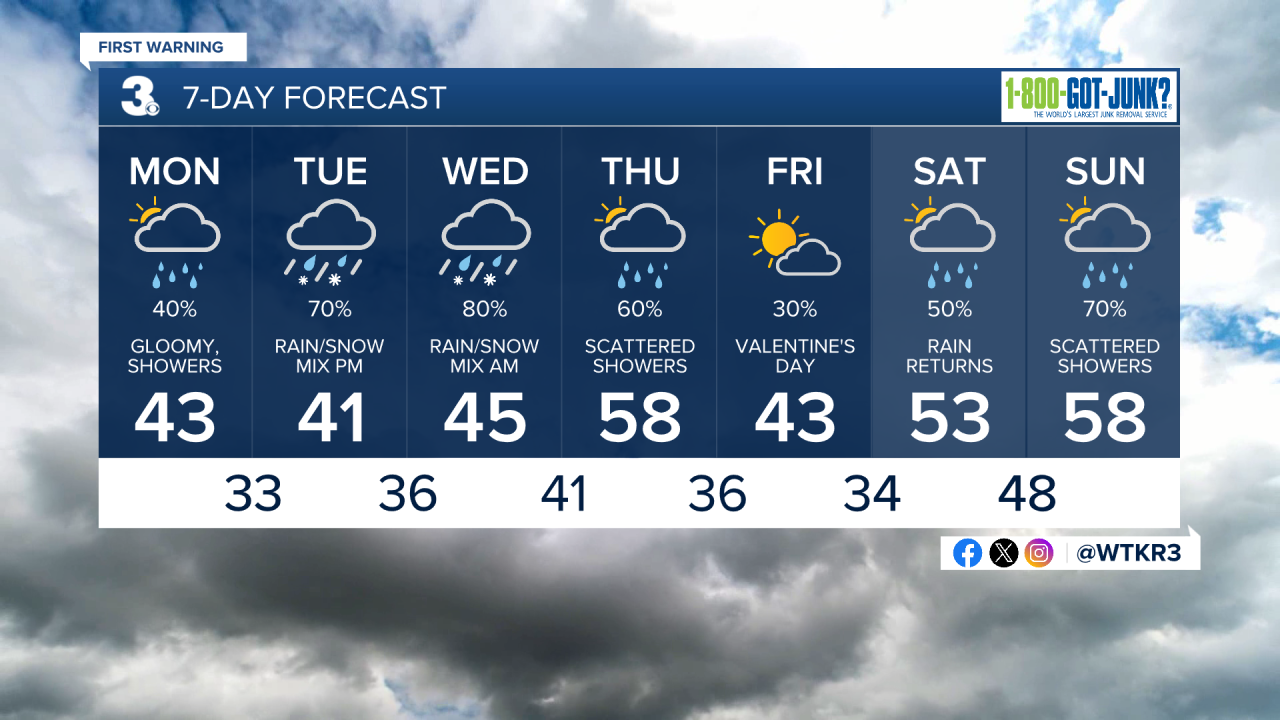
This evening we say goodbye to the mild weather and hello to more rain chances. The rain will stick around throughout the week with a few chances for winter weather Tuesday into Wednesday morning.
Scattered showers arrive tonight and into tomorrow morning. Most of the rain will be moving out in the afternoon but the clouds will stick around. High temperatures will be in the low 40s.
We remain cold and rainy for the rest of the week. A rain/snow mix will be possible Tuesday. Flurries will be more likely for our northern spots in the Peninsulas closer to Richmond. Sleet and freezing rain will be possible for Southside and mainly rain for northeast North Carolina. Temperatures come up a bit Wednesday melting any ice and snow that accumulates.
We dry out briefly for Valentine's Day Friday before more scattered showers arrive next weekend.
Let's connect on social media!
Forecaster Derrah Getter:
For weather updates on Facebook: HERE
For weather updates on X: HERE
Follow me on Instagram: HERE
Check out the Interactive Radar on WTKR.com: Interactive Radar
