


Meteorologist Myles Henderson’s First Warning Forecast
The warm stretch continues with highs in the 60s and 70s. Tracking rain for Thursday night.
Another nice day today with a mix of mostly sunny to partly cloudy skies. Highs will reach the low to mid 60s, cooler than yesterday but still above normal.

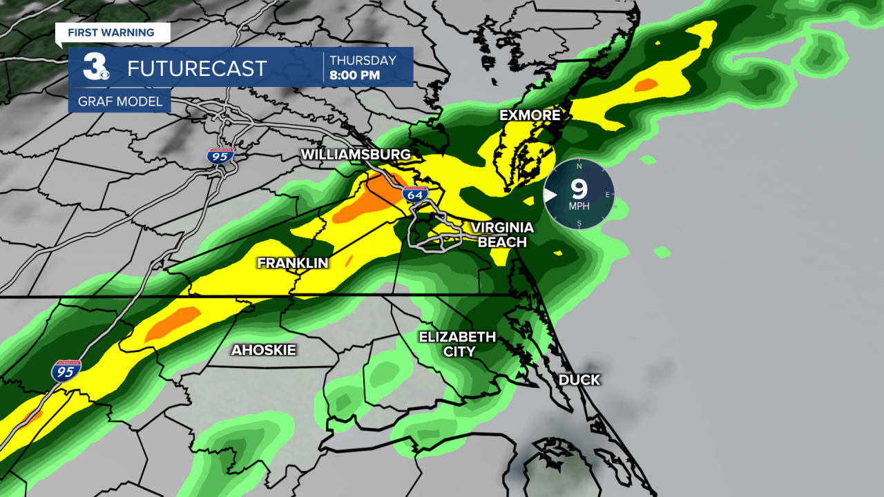
Temperatures will climb to the low 70s tomorrow, 15 degrees above normal for this time of year. We will see a mix of partly to mostly cloudy skies. Showers are set to move in Thursday evening/night with a cold front.
Cooler air moves in behind the front with highs in the mid 50s on Friday. Any leftover showers will clear out very early Friday morning and sunshine will return.
Get ready for a big temperature swing this weekend. Highs will climb to the upper 60s on Saturday then drop to the mid 40s on Sunday.

Today: Sun & Clouds. Highs in the mid 60s. Winds: N/E/S 5-10
Tonight: Partly Cloudy. Lows in the upper 40s. Winds: S 5-10
Tomorrow: Mix of Clouds, Evening Rain. Highs in the low 70s. Winds: SW 10-20
Weather updates on social media:
Facebook: MylesHendersonWTKR
Instagram: @MylesHendersonWTKR
