


Meteorologist Myles Henderson’s First Warning Forecast
Tropical system developing along the Carolina coast. Showers, storms, and wind to start the week.
We will see a mix of partly to mostly cloudy skies today with scattered showers and storms building in. Rain chances will be higher in NC and lower in VA. It will be windy again today, NE at 10 to 20 with gusts to 30 mph. The strong NE winds could trigger coastal flooding near times of high tide.

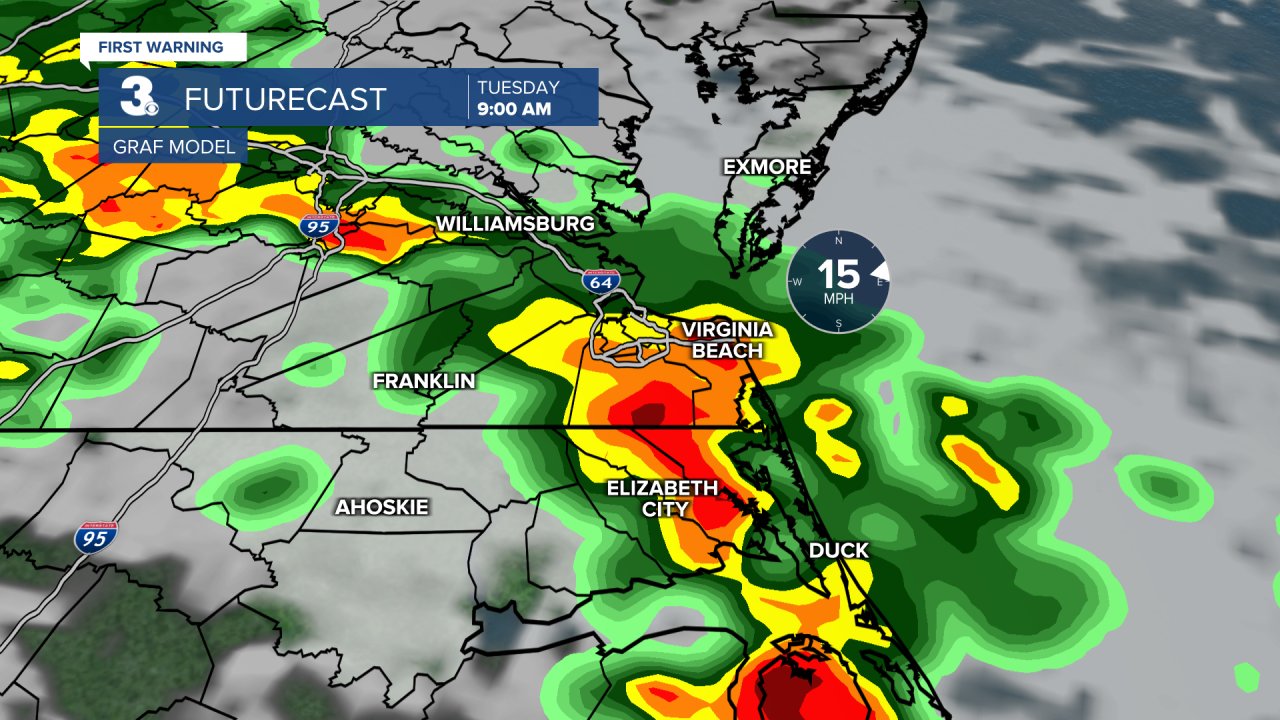
A soggy and windy Tuesday. Expect mostly cloudy skies with showers and storms. Rain could be heavy at times with isolated storms. Strong to severe storms are possible including a risk for tornadoes. It will still be windy tomorrow with an east wind at 10 to 20 and gusts to 30 mph.
Winds will back down for the second half of the week. Expect a mix of clouds with scattered showers and storms lingering throughout the week. High temperatures will stay in the upper 70s to low 80s all week.
Today: Rain & Windy. Highs upper 70s. Winds: NE 10-20 G30
Tonight: Rain & Windy. Lows near 70. Winds: NE 10-20 G30
Tomorrow: Rain & Windy. Highs in the upper 70s. Winds: E 10-20 G30
Tropical Update
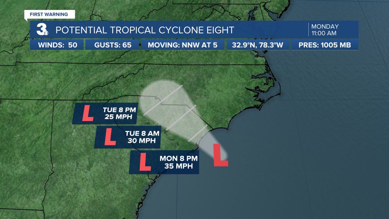
Potential Tropical Cyclone Eight slowly approaching the South Carolina coast. On the forecast track, the low will reach the coast of South Carolina this afternoon and then move inland across the Carolinas tonight through Wednesday.
Maximum sustained winds are near 50 mph with higher gusts. Little change in strength is expected before the system reaches the coast, and the low still has a chance of becoming a tropical or subtropical storm. Weakening is forecast after the system moves inland, and it is likely to dissipate over the Carolinas by Wednesday.
Tropical Depression Gordon continues moving over the central Atlantic. A westward motion is expected during the next day or so, then a turn to the north.
Weather & Health
Pollen: Medium (Ragweed)
UV Index: 4 (Medium)
Air Quality: Good (Code Green)
Mosquitoes: Very High
Weather updates on social media:
Facebook: MylesHendersonWTKR
Instagram: @MylesHendersonWTKR
X (Twitter): @MHendersonWTKR
