


Meteorologist Myles Henderson’s First Warning Forecast
Several chances for showers and storms this week. Not as hot, but still very humid.
Mostly cloudy skies with showers and storms throughout the day. Rain will be heavy at times with a risk for flooding and a threat for severe storms. Highs will only reach the mid 80s today, but it will be humid.

Expect partly to mostly cloudy skies with scattered showers and storms through the work week as a stationary front lingers over the Mid-Atlantic. Highs will warm to the upper 80s with a heat index near 100 for Tuesday and Wednesday.
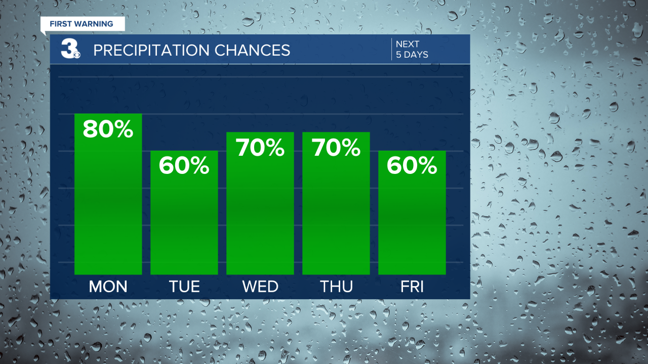
A cold front is set to move through Friday to Saturday, helping to reset our weather pattern. Rain chances will decrease, and we should see more sunshine mix in for the weekend. Highs will settle in the mid 80s with a dip in humidity behind the front.
Today: Showers & Storms. Highs in the low 80s. Winds: S 5-10
Tonight: Showers & Storms. Lows in the mid 70s. Winds: S 5-10
Tomorrow: Scattered Storms. Highs in the upper 80s. Winds: SW 5-10
Tropical Update
No tropical activity at this time
Weather & Health
Pollen: Low (Grasses)
UV Index: 2 (Low)
Air Quality: Good (Code Green)
Mosquitoes: Extreme
Weather updates on social media:
Facebook: MylesHendersonWTKR
Instagram: @MylesHendersonWTKR
X (Twitter): @MHendersonWTKR
