


Meteorologist Myles Henderson’s First Warning Forecast
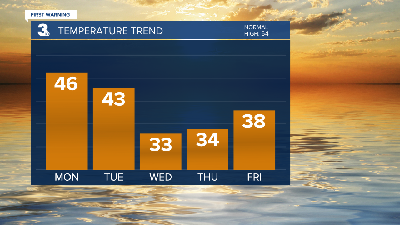
A chilly week with highs in the 30s and 40s. Tracking significant snow potential for midweek.
Sunny and chilly to kick off the week. Expect mostly sunny skies today with highs in the mid 40s. It will still be windy today with a NW wind at 10 to 20 and gusts 20 to 30 mph. Winds will relax later today and tonight.

Highs in the low to mid 40s on Tuesday with partly cloudy skies and light winds.
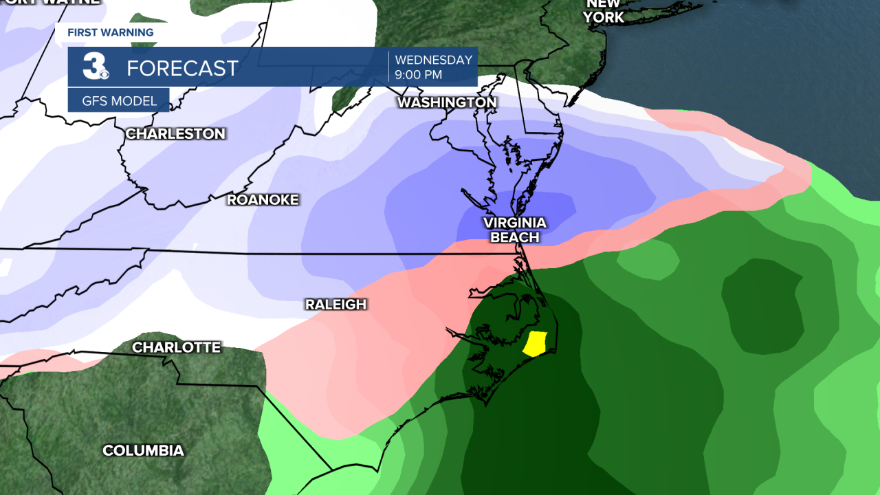
An area of low pressure is set to track across the Southeast Wednesday to Thursday. This system has the potential to bring us significant snowfall. Showers will start Wednesday morning to midday and move out Thursday morning to midday. The biggest question mark is the location of the rain/snow line. The latest trend has been the rain/snow line lingering over NE NC to the VA/NC line. That would put the highest snow totals over eastern VA with more of a mix of precipitation (and lower snow totals) in eastern NC.
Highs will struggle to reach the mid 30s on Wednesday and Thursday. It will also get windy again. Winds will start to ramp up on Wednesday and wind gusts could reach 30+ mph on Thursday.
We will dry out for the end of the week, but it will still be chilly with highs in the 30s and 40s for Friday and the weekend.
Today: Mostly Sunny. Highs in the mid 40s. Winds: NW 10-20G30
Tonight: A Few Clouds. Lows in the low 30s. Winds: W 5-15
Tomorrow: Partly Cloudy. Highs in the low 40s. Winds: N 5-10
Weather updates on social media:
Facebook: MylesHendersonWTKR
Instagram: @MylesHendersonWTKR
