


Chief Meteorologist Patrick Rockey’s First Warning Forecast
From sunny, cold and dry to warmer, windy and wet. That's our forecast for the next week in a nutshell.
A cold front moving through Wednesday evening will send temperatures tumbling on Thursday. We expect high temperatures only in the mid 40s, despite plenty of sunshine.
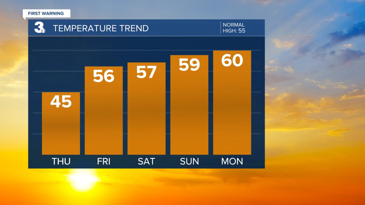
After that, we expect a nice warming trend. The mercury will climb back to near 60 degrees by Sunday. But the trade off is rain and wind.
An area of low pressure will push up the coast, bringing rain beginning on Sunday.

The eventual track of this low will have a big impact on what we can expect. If the low stays over land, we can expect some rain and some wind Sunday and Monday.
If the low hugs the coast, it will intensify over the Gulf Stream waters. That will bring us heavier downpours, gustier winds and the potential for tidal flooding.

As it stands we're expecting anywhere from 1.5 to 2.5" of rain. If the storm intensifies, we could see wind gusts over 40 mph, along with the threat of tidal flooding. Stay tuned.
