Meteorologist Kristy Steward's First Warning Forecast
Happy Thursday evening! It sure felt like Spring today with high temperatures in the mid 70s. We were just one degree shy of tying the record high of 77° in Norfolk. Obviously this isn’t typical weather for February and we must see a cool down some time. That cool down is coming tomorrow.
Ahead of a powerful cold front, clouds will continue to build tonight and winds stay on the stronger side. 10-20 MPH southerly winds with gusts up to 30 MPH. Temperatures stay warm all night. Lows only drop into the low 60s.
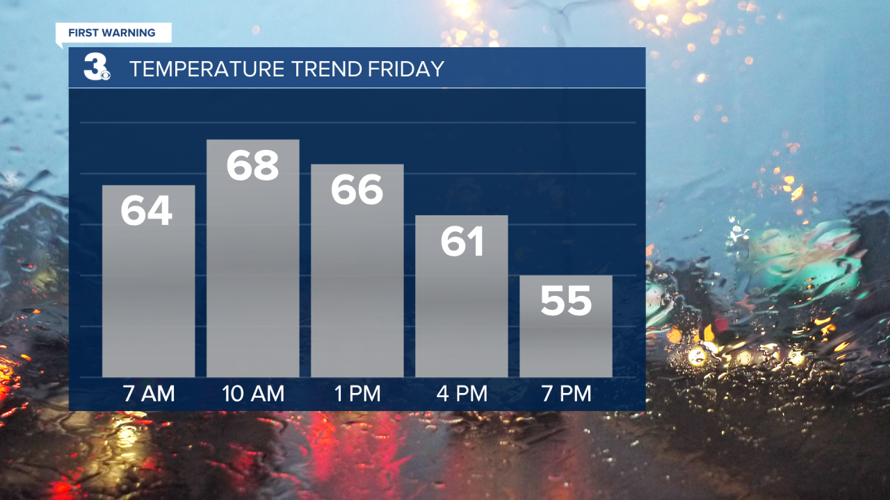
Friday will be one of those days you’ll have to grab a jacket for later in the day. The cold front passes through midday, dropping temperatures the second half of Friday. Highs in the upper 60s will be reached around 10 AM, then temperatures gradually drop to the upper 50s for Friday evening.

Throughout the daytime hours Friday, expect stronger winds and scattered showers. Rain starts to move in from the west around 7 AM and continues up until sunset. There could be some heavier downpours at times and some rumbles of thunder, but no severe weather is expected.
Friday night gets really cold. Lows around freezing. Saturday stays chilly as highs only rise into the mid and upper 40s, despite a lot of sunshine.
It’s a short-lived cool down. Sunday temperatures rebound into the upper 50s. We’ll stay dry all weekend, just noticing more cloud cover Sunday ahead of an unsettled stretch.
In this unsettled stretch spanning next week, we’ll have more clouds than sun, breezy winds, and daily chances for isolated rain showers. Temperatures will also continue climbing. Highs for the workweek in the low to mid 60s. We could even flirt with 70° again next Thursday!
Connect with Meteorologist Kristy Steward:
FACEBOOK
TWITTER
INSTAGRAM


