Meteorologist Kristy Steward's First Warning Forecast
Happy Friday evening! A fantastic weekend is in store for us before an unsettled pattern brings us a cloudy and soggy stretch for much of the workweek.
Underneath a mostly clear sky, temperatures drop to the low 30s again tonight. The sunshine continues Saturday and temperatures will rise into the mid and upper 50s. We get even warmer into the low 60s on Sunday! We should stay mostly dry Sunday, but a stray shower can’t be ruled out during the afternoon and evening hours as clouds start to build ahead of this unsettled stretch.

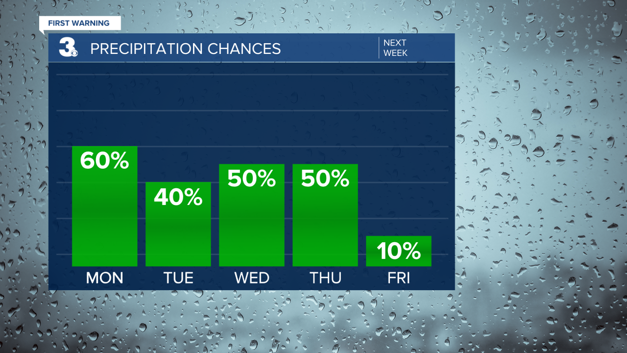
Next week, several fronts and systems will pass through, putting us in an unsettled weather pattern through Thursday. With this pattern, temperatures and the timing of precipitation will likely change the next several days as there’s a fair amount of uncertainty.
That said, it looks like our first round of rain showers will be Sunday night throughout Monday morning. Then, another round Tuesday afternoon. Currently, our long-range model is showing the potential for some snow flurries across the Peninsulas and Eastern Shore Tuesday evening. If we do see flurries in those areas, they likely won’t amount to any accumulation. Again, timing is key and the timing of that round of precipitation could change and we all may end up with only rain showers. Temperatures Tuesday will be in the upper 40s, cooling into the upper 30s Tuesday night.
Expect another round of scattered rain showers Wednesday, likely in the evening continuing into Thursday. Cooler air starts to work its way in Wednesday night and we continue to gradually get cooler the rest of the workweek. Right now, it looks like highs in the mid to upper 40s Wednesday with lows Wednesday night in the mid 30s. That means there’s the potential for a bit of a mix Wednesday night.
Thursday has forecasted highs in the mid 40s and lows around 30°. So, I think Thursday is our better chance at seeing some snow mixed in. Scattered rain showers throughout the day could changeover to snow in the evening if precipitation continues to fall once temperatures drop below freezing. Again, timing is key and it’s way too early to make a snow call just yet. This is just an early heads up that we might see something, but I expect changes in the forecast with this unsettled pattern over the next week. Stay tuned as this forecast changes!

Next Friday will again be the coldest day of the week with highs around 40°, but the sun will finally make an appearance again as we move out of that unsettled pattern!
Connect with Meteorologist Kristy Steward:
FACEBOOK
TWITTER
INSTAGRAM


