


Meteorologist Kristy Steward's First Warning Forecast
Happy Saturday evening! Christmas is right around the corner and the forecast is still looking good through Christmas Day. After that is when the rain arrives.
Ahead of this rain making system, moisture is gradually building in the atmosphere and temperatures are rising. With this, patchy fog will develop tonight, especially along the coast. Patchy morning fog could continue for several days.

Christmas Eve and Christmas Day will be very similar to each other. Both partly cloudy and dry with highs in the low 60s. Christmas Day will be a couple degrees warmer than Christmas Eve.

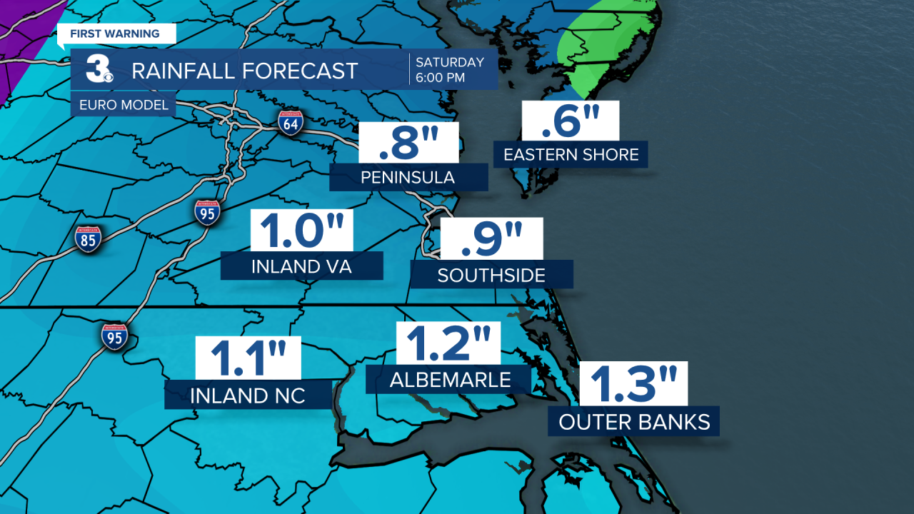
The timing of the rain looks to have moved back some. It looks like spotty showers late Monday night through Tuesday morning. Scattered showers now look to move in Tuesday afternoon and continue through Wednesday. Overall, around 1” of rain is expected. It’s still set to be a warm rain as high temperatures will be in the low to mid 60s and overnight lows will be in the low 50s.
Behind this system, a few sprinkles are possible, but we should be mostly dry with sun and clouds. Temperatures will flip to a cooling trend. Highs in the mid 50s Thursday down to the mid to upper 40s next Saturday.
Connect with Meteorologist Kristy Steward:
FACEBOOK
TWITTER
INSTAGRAM
