


Meteorologist Kristy Steward's First Warning Forecast
Happy Friday evening! We had some scattered rain showers move in today and our warming trend continued. This same pattern sticks around for the weekend.
Tonight will be much warmer. Lows in the upper 50s to low 60s. Saturday, temperatures will rise into the upper 60s, even possibly touching 70° in some places! There will be a few spotty showers Saturday morning, but if you’re looking for a dry time, the morning is your best bet. Scattered to widespread rain returns for the afternoon and evening hours. We could even hear a rumble of thunder.
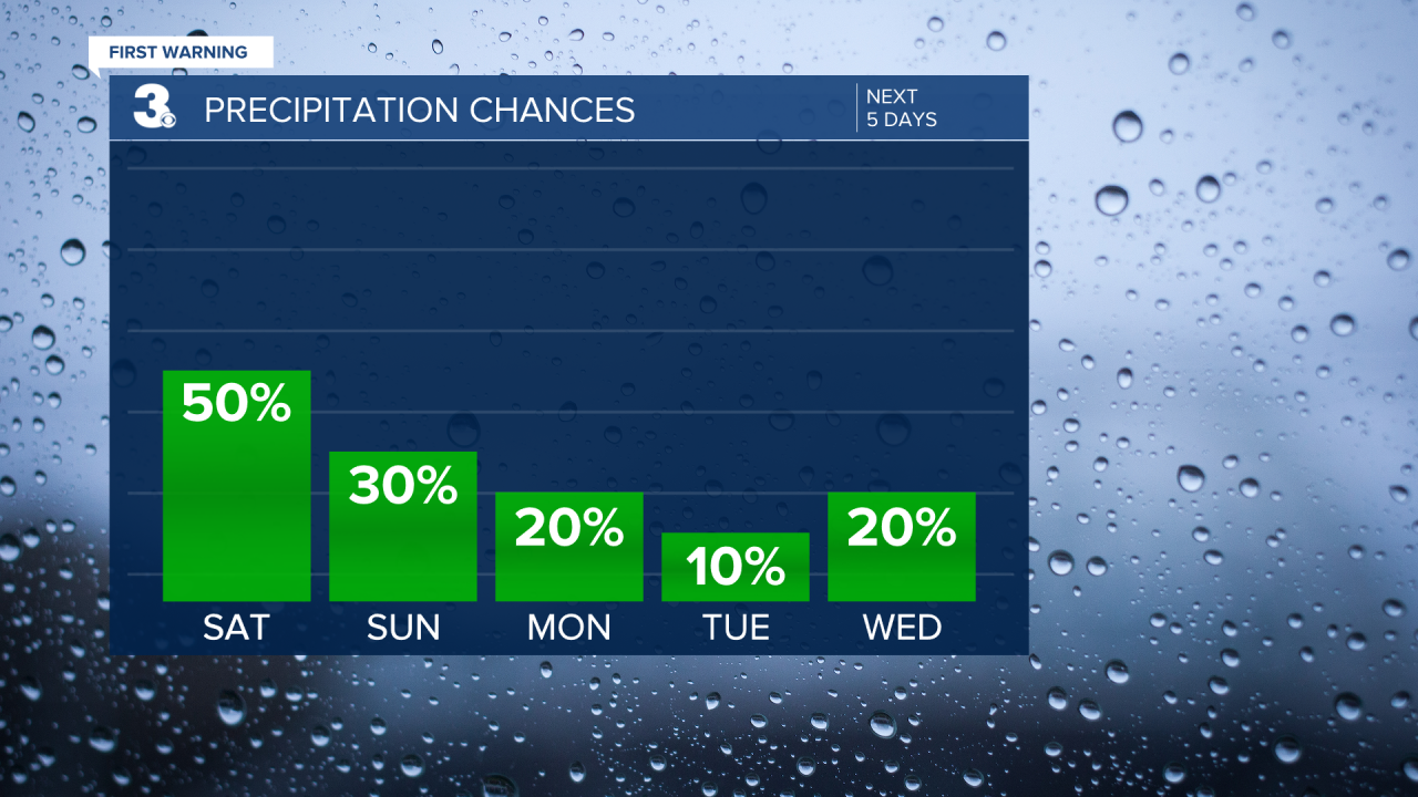
Sunday is a better day than Saturday for outdoor plans. Isolated showers will still be around, but not as much rain as Saturday. High temperatures will be in the mid to upper 60s.
This system clears out of here early Monday, leaving us with a mostly dry work week ahead and a mix of sun and clouds. Temperatures will gradually fall as the week goes on. Highs around 60° Monday become highs in the upper 40s by Thursday. We should start to warm up to the mid 50s Friday. Overnight lows next week will be back in the mid to upper 30s.

Connect with Meteorologist Kristy Steward:
FACEBOOK
TWITTER
INSTAGRAM
