
Meteorologist April Loveland's First Warning Forecast
Friday ended up being a record-breaking day. Norfolk and Elizabeth City tied the record high of 77 degrees and Wallops Island shattered the record high by warming all the way up to 76 degrees.

Friday was nice while it lasted, but reality is about to set in.
We are just 52 days away from Spring, and while the next few days will be above normal, we've got cooler air moving in to kick off the work week.

Saturday will be cooler than Friday, but temperatures will still be above normal with highs in the upper 50s. We'll see more sunshine in the morning, with clouds building in by the afternoon. Scattered showers will be possible later today. We will also have to deal with marine fog coming and going today.

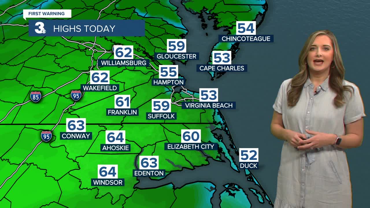
Showers will continue overnight and into the day Sunday. Wet weather will be possible through the afternoon. Temperatures will be mild with highs in the mid 60s.

Temperatures will take a plunge to kick off the work week. Expect highs in the mid and upper 40s for both Monday and Tuesday. It will be windy and cold Monday with winds out of the northwest at 15-20 mph.
We could see a few showers on Wednesday and Thursday. We'll see highs near 50 both days.
We'll warm to the mid 50s with a nice mix of sun and clouds on Friday.
Meteorologist April Loveland
For weather updates on Facebook: HERE
Follow me on Twitter: HERE
Follow me on Instagram HERE
Check out the Interactive Radar on WTKR.com: Interactive Radar
