

Meteorologist April Loveland's First Warning Forecast
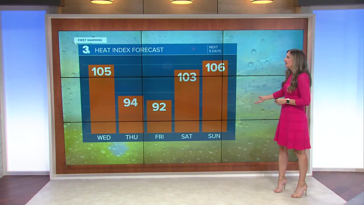
Humidity and temperatures will be on the rise again on Wednesday. Highs will soar to the mid 90s, but it will feel closer to the triple digits once we factor in the humidity. A cold front will approach, so we're keeping a slight chance for a shower or storm late in the day. A strong to severe storm is possible, especially for the peninsulas and Eastern Shore.
Scattered showers and storms will be possible on Thursday. Highs will warm to the upper 80s.
Temperatures will get knocked down a bit on Friday. Expect highs in the mid 80s, but it will still be humid. Skies will be partly cloudy.
The weekend is looking hot and humid. Temperatures will soar to the low 90s both Saturday and Sunday. Saturday is looking mostly dry, but a spotty shower or storm cannot be ruled out. Showers and storms are looking more likely on Sunday. Both days will have heat index values in the triple digits.
The start of the work week will bring the chance for more storms, but milder weather.
Meteorologist April Loveland
For weather updates on Facebook: HERE
Follow me on Twitter: HERE
Follow me on Instagram HERE
Check out the Interactive Radar on WTKR.com: Interactive Radar
