


Derrah Getter's First Warning Forecast
An area of low pressure could become a tropical storm within the next day or so.
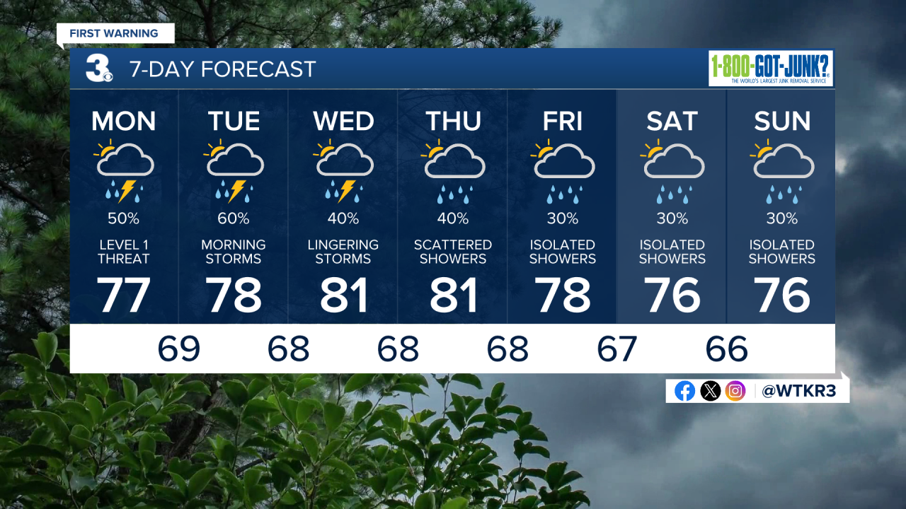
The first batch of rain arrives Monday. There is an isolated severe thunderstorm risk late Monday night into early Tuesday morning. Primary threats include damaging winds, heavy rain which could lead to localized flooding, and an isolated tornado isn't out of the question. 1-3 inches of rain is expected through Friday.

The worst of the wet weather is expected Tuesday morning. Rain chances for the rest of the week will remain elevated. Scattered showers and storms are possible Wednesday. More isolated rain chances will stick around through the end of the upcoming weekend. Highs during the upcoming week will generally be around the upper 70s and low 80s.
Let's connect on social media!
Forecaster Derrah Getter:
For weather updates on Facebook: HERE
For weather updates on Twitter: HERE
Follow me on Instagram: HERE
Check out the Interactive Radar on WTKR.com: Interactive Radar
