Meteorologist April Loveland's First Warning Forecast
**FLASH FLOOD WATCH until 10 PM Monday for York, James City, Williamsburg, Gloucester, Mathews, Middlesex
Rounds of showers and storms today with highs in the mid 80s. Localized flooding will once again be a concern. Especially in areas that have already seen rain from Saturday and Sunday.
Not as wet on Tuesday and Wednesday and temperatures will begin to warm to the upper 80s. Still keeping a chance for a few showers and storms.
The unsettled weather will continue into the end of the week with a lot of moisture available due to the atmospheric setup. Temperatures will continue to trend in the 80s. Keep the umbrella handy this week!
Tropical Update
Fred is moving toward the north-northeast near 9 mph, and this general motion is expected through tonight. On the forecast track, the center of Fred should make landfall in the eastern Florida Panhandle this afternoon or early this evening, and move over western Georgia on Tuesday. Data from an Air Force Reserve Hurricane Hunter aircraft indicate that maximum sustained winds are near 65 mph with higher gusts. Little change in strength is expected before landfall. After landfall, Fred is expected to quickly weaken. Tropical-storm-force winds extend outward up to 115 miles from the center. A wind gust of 58 mph was recently reported at Bald Point, Florida.

Tropical Storm Grace is located about 70 miles SE of Port Au Prince Haiti. Grace is now moving toward the west-northwest near 12 mph, and this general motion is expected to continue over the next several days. On the forecast track, the center of Grace will move over or near the Tiburon Peninsula of Haiti this afternoon and tonight, and then pass between Jamaica, Cuba, and the Cayman Islands on Tuesday and Wednesday. Maximum sustained winds are near 35 mph with higher gusts. Some strengthening is forecast during the next few days, and Grace is expected to become a tropical storm again by Tuesday.

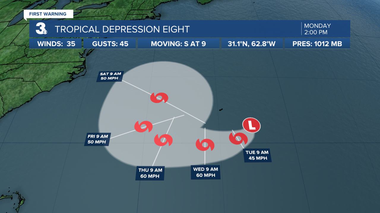
Tropical Depression Eight is moving toward the south near 9 mph. A slow clockwise turn toward the southwest and then toward the west is expected during the next few days. On the forecast track, the center of the depression will move well to the south of Bermuda. Maximum sustained winds are near 35 mph with higher gusts. Some strengthening is forecast during the next few days, and the depression is expected to become a tropical storm later today or tonight.

Meteorologist April Loveland
For weather updates on Facebook: HERE
Follow me on Twitter: HERE
Follow me on Instagram HERE
Check out the Interactive Radar on WTKR.com: Interactive Radar


