More heat and humidity… Highs will warm to the low and mid 90s this afternoon, a few degrees warmer than yesterday. Afternoon heat index values will climb to the upper 90s. Expect mostly sunny skies today with just a few clouds mixing in.
Wednesday will be the hottest day of the week. Highs will climb to the mid 90s with an afternoon heat index near 100. Expect mostly sunny to partly cloudy skies.
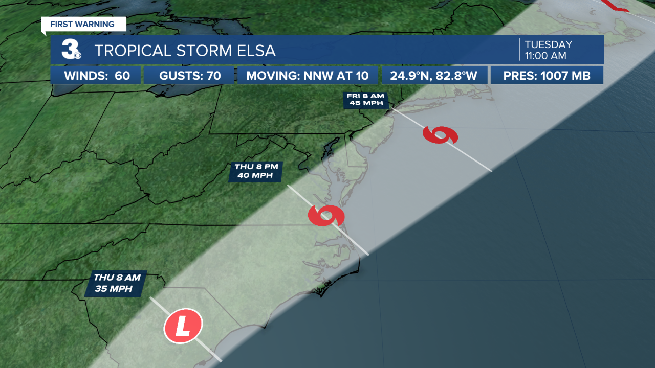
Tropical Storm Elsa will be moving up the East Coast this week. This system will be closest to us on Thursday. Expect rain, wind, and a risk for severe storms (including tornadoes). Most of the area will see 1” to 3” of rainfall, winds could gust to 30+ mph, and isolated tornadoes are possible.
We will be back to a summer-like pattern for Friday and the weekend. Highs will return to the upper 80 to low 90s. A “pop-up” shower or storm is possible each day with a mix of sun and clouds.
Tropical Update
Tropical-storm-force winds and heavy rain over the Florida Keys. Tropical Storms Elsa is centered about 65 miles WNW of Key West, Florida and moving NNW at 10 mph.
On the forecast track, Elsa will continue to pass near the Florida Keys this morning and move near or over portions of the west coast of Florida later today through tonight. On Wednesday morning, Elsa is forecast to make landfall along the north Florida Gulf coast and then move across the southeastern United States through Thursday.
Maximum sustained winds are near 60 mph with higher gusts. Slow strengthening is forecast through tonight, and Elsa could be near hurricane strength before it makes landfall in Florida. Weakening is expected after Elsa moves inland.
Tropical-storm-force winds extend outward up to 70 miles from the center.


Weather & Health
Pollen: Low-Medium (Grasses)
UV Index: 9 (Very High)
Air Quality: Good (Code Green)
Mosquitoes: Very High
Meteorologist April Loveland
For weather updates on Facebook: HERE
Follow me on Twitter: HERE
Follow me on Instagram HERE
Check out the Interactive Radar on WTKR.com: Interactive Radar


